1
Carrington, Nottingham NG5
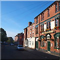
A view of the Gladstone Hotel on Loscoe Road, looking towards Oak Street, its continuation.
Image: © David Hallam-Jones
Taken: 12 Oct 2014
0.01 miles
2
Carrington, Nottingham, NG5
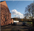
The Gladstone Hotel on Loscoe Road.
Image: © David Hallam-Jones
Taken: 12 Oct 2014
0.02 miles
3
Nottingham, NG5 - "Sherrington"
This is Oak Street that runs almost parallel with Mansfield Road (the A60). A run of concrete Toblerone-shaped triangles at the foot of the "No Entry" sign mark the start of Loscoe Road, home to the popular "Gladstone" pub that hosts the weekly "Carrington Triangle Folk Club". This end of Oak Street is very close to the back of the former Carrington Post Office, a victim of the 2007/08 cut-backs. A large care home is currently being built behind the security fencing on the left.
Image: © David Hallam-Jones
Taken: 4 Nov 2012
0.04 miles
4
Nottingham, NG5 - "Sherrington"
The closed end of Welsley Street (a cul-de-sac) off Oak Street, the latter being close to the back of the former Carrington Post Office, a victim of the 2007/08 cut-backs.
Image: © David Hallam-Jones
Taken: 4 Nov 2012
0.04 miles
5
Nottingham, NG5 - "Carrington"
A path that connects Wesley Street, Carrington with Hucknall Road, Carrington taken from the closed end of Welsley Street (a cul-de-sac). The red brick building on the right is used jointly by the 2418 (Sherwood) Squadron/Air Training Corps and the Sherwood Army Cadet Force whereas the building beyond it is a British Telecom depot. with an entrance off Wesley Street in the distance. The playing field on the left belongs to neighbouring Carrington Primary and Nursery School.
Image: © David Hallam-Jones
Taken: 4 Nov 2012
0.05 miles
6
Loscoe Road, Carrington
In the back streets just west of Mansfield Road, this shows the junction of Loscoe Road and Sherbrooke Road. The Gladstone Hotel - a pub - can be seen a little further up Loscoe Road.
Image: © Stephen McKay
Taken: 18 Apr 2015
0.05 miles
7
The Gladstone
Image: © David Lally
Taken: 3 Apr 2024
0.05 miles
8
Nottingham, NG5 -"Sherrington"
A view of the straight stretch of Welsley Street taken with the closed end of it (a cul-de-sac) behind the photographer. In the distance a 90 degree turn to the left makes a connection with Oak Street, the latter being close to the back of the former Carrington Post Office, a victim of the 2010/11 cut-backs. The playing field belongs to Carrington Primary and Nursery School situated on Hucknall Road and the run of canvas sheeting clipped to the fencing on the left represents an attempt to keep children using the playing field and construction workers on the building site - behind the fencing - from seeing each other!
Image: © David Hallam-Jones
Taken: 4 Nov 2012
0.05 miles
9
Carrington, Nottingham NG5
Acorn House, a new-ish (2013) residential care-of-the-elderly and dementia care unit on the corner site created by the Oak Street and Wesley Street junction. In the distance, Oak Street continues as Jenner Street. "The Gladstone" public house - a popular local pub - lies 30 seconds walk away, behind the photographer.
Image: © David Hallam-Jones
Taken: 12 Oct 2014
0.05 miles
10
Buildings on Wesley Street from Loscoe Road
A view across a small patch of wasteland to the backs of houses and a factory that are both at right angles to Wesley Street. The houses to the left, beyond the tree, are on Ebury Road, which is just off Hucknall Road.
Image: © Richard Vince
Taken: 4 Jan 2010
0.05 miles


