
IMAGES TAKEN NEAR TO
York Close, NOTTINGHAM, NG4 4WD
Introduction
This page details the photographs taken nearby to York Close, NG4 4WD by members of the Geograph project.
The Geograph project started in 2005 with the aim of publishing, organising and preserving representative images for every square kilometre of Great Britain, Ireland and the Isle of Man.

There are currently over 7.5m images from over14,400 individuals and you can help contribute to the project by visiting https://www.geograph.org.uk
Image Map
Images are licensed for reuse under creativecommons.org/licenses/by-sa/2.0
Notes
- Clicking on the map will re-center to the selected point.
- The higher the marker number, the further away the image location is from the centre of the postcode.
Image Listing (112 Images Found)
Images are licensed for reuse under creativecommons.org/licenses/by-sa/2.0
Image
Details
Distance
1
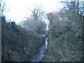
Railway trackbed, Gedling (1)
Maps generally still seem to mark this as a railway line, though here, where there was a foot crossing between Jessops Lane and a footpath, the track appears to have been lifted. This was the Great Northern Railway's "back line", which turned through 180 degrees around the edge of greater Nottingham to head eventually west into Derbyshire. After closure as a through route in the early 1960s, this section survived to provide rail access to Gedling Colliery, which closed in 1991.
Image: © Richard Vince
Taken: 11 Feb 2014
0.07 miles
2
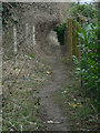
Footpath along the railway
This path leads out of the corner of Lambley Lane Recreation ground towards Gedling village, but there is no evidence of right of way across the recreation ground itself.
Image: © Alan Murray-Rust
Taken: 1 Feb 2009
0.07 miles
3
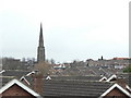
Across the rooftops
The delicate 13th century spire of Gedling church seen from Lambley Lane Recreation Ground.
Image: © Alan Murray-Rust
Taken: 1 Feb 2009
0.08 miles
4
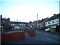
Grange Crescent, Gedling
Despite its name, this is a straight cul de sac.
Image: © Richard Vince
Taken: 11 Feb 2014
0.08 miles
5
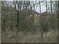
Houses on Jessops Lane
Seen from the footpath alongside the former railway line.
Image: © Alan Murray-Rust
Taken: 1 Feb 2009
0.09 miles
6
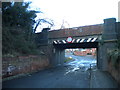
Railway bridge over Jessops Lane, Gedling
The railway here is the Great Northern Railway's "back line", which turned through 180 degrees around the edge of greater Nottingham to head eventually west into Derbyshire. After closure as a through route in the early 1960s, this section survived to provide rail access to Gedling Colliery, which closed in 1991.
Image: © Richard Vince
Taken: 11 Feb 2014
0.10 miles
7
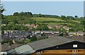
View from Phoenix Avenue
Looking across the valley of the Ouse Beck to Gedling Wood. The hill doesn't appear to have a name of its own.
Image: © Alan Murray-Rust
Taken: 30 May 2020
0.11 miles
8
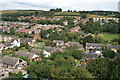
View from All Hallows Church Steeple, Gedling
Taken from half way up the 180ft steeple which dates from 1320.
Image: © Martin Jones
Taken: 16 Sep 2009
0.11 miles
9
Jessops Lane, Gedling
Seen from the tower of All Hallows Church – an unexpected bonus on a casual visit.
Image: © Alan Murray-Rust
Taken: 8 Jan 2020
0.11 miles
10
Grange View Road
The spire of All Hallows church, Gedling in the distance.
Image: © Jonathan Thacker
Taken: 5 Jun 2018
0.12 miles