
IMAGES TAKEN NEAR TO
Green Lane, NOTTINGHAM, NG4 4QE
Introduction
This page details the photographs taken nearby to Green Lane, NG4 4QE by members of the Geograph project.
The Geograph project started in 2005 with the aim of publishing, organising and preserving representative images for every square kilometre of Great Britain, Ireland and the Isle of Man.

There are currently over 7.5m images from over14,400 individuals and you can help contribute to the project by visiting https://www.geograph.org.uk
Image Map
Images are licensed for reuse under creativecommons.org/licenses/by-sa/2.0
Notes
- Clicking on the map will re-center to the selected point.
- The higher the marker number, the further away the image location is from the centre of the postcode.
Image Listing (75 Images Found)
Images are licensed for reuse under creativecommons.org/licenses/by-sa/2.0
Image
Details
Distance
1

Cottages on Green Lane
The nearer boundary of the gardens probably represent the old boundary of the 'green', from which the lane gets its name. Many of the dwellings subsequently built on the green area, like the upper ones here, are built at right angles to the road, with front gardens parallel to the road. This would have allowed more garden area per dwelling than if they had been built facing the road. The row still consists of two dwellings.
Image: © Alan Murray-Rust
Taken: 17 Oct 2008
0.01 miles
2
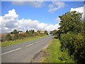
Green Lane, Lambley (1)
Looking towards Woodborough as the houses thin out at the north end of Lambley.
Image: © Richard Vince
Taken: 10 Oct 2014
0.07 miles
3
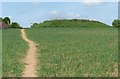
Round Hill, Lambley
For long thought to be a castle motte, it is likely to be the site of a post-mill of which there are records from the 14th century. The site is a scheduled monument.
Image: © Alan Murray-Rust
Taken: 20 May 2020
0.11 miles
4

Green Lane
Looking up the hill. This lane was once a wide green providing common grazing for the village. The houses on either side stand on what was once open common.
Image: © Alan Murray-Rust
Taken: 17 Oct 2008
0.12 miles
5

The 'Mound'
Marked (on the 1:25000 map) as a scheduled monument, the origin is still obscure. Originally thought to be a castle mound, it is now believed to be the site of a windmill, although there was another one in the village.
Image: © Alan Murray-Rust
Taken: 17 Oct 2008
0.13 miles
6

Green Lane
The entry to Lambley village. The lane was once a wide green, including the land where houses can now be seen on both sides of the road, providing common grazing rights for the village.
Image: © Alan Murray-Rust
Taken: 17 Oct 2008
0.14 miles
7

'Mound' on Round Hill
Shown simply as 'Mound' in antique lettering on the 1:25000 map, it was long thought to be a castle mound, but is now believed to be the site of a windmill. It is a scheduled monument.
Image: © Alan Murray-Rust
Taken: 17 Oct 2008
0.15 miles
8
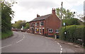
Lambley NG4, Notts.
"The Woodlark" pub and restaurant near the junction of "The Dumbles" (a private road that also hosts a public footpath) and Church Lane. The centre of the village lies 3-4 minutes walk ahead.
Image: © David Hallam-Jones
Taken: 12 May 2013
0.16 miles
9
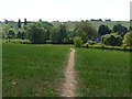
Footpath near Lambley
There is a network of footpaths in the neighbourhood, most of which show evidence of a high level of use.
Image: © Alan Murray-Rust
Taken: 20 May 2020
0.16 miles
10
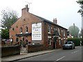
The Woodlark Inn
Restaurant & Steak Bar in Lambley village
Image: © Graham Hogg
Taken: 25 Oct 2016
0.16 miles