1
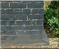
Bench mark, Bridge over the Ouse Dyke, Chandos Street
See http://www.geograph.org.uk/photo/5024100 for location.
Image: © Alan Murray-Rust
Taken: 4 Jul 2016
0.04 miles
2
Bridge over the Ouse Dyke, Chandos Street
The road rises considerably to cross what is quite a small stream. There is a bench mark http://www.geograph.org.uk/photo/5024102on the parapet to the left.
Image: © Alan Murray-Rust
Taken: 4 Jul 2016
0.05 miles
3
Conway Crescent
A quiet backwater of tween-wars housing on the garden suburb principle.
Image: © Alan Murray-Rust
Taken: 8 May 2008
0.07 miles
4
Colwick Loop Road
Hardly 25 years old, this bypass has itself been superseded by a new road a bit further east.
Image: © Alan Murray-Rust
Taken: 8 May 2008
0.11 miles
5
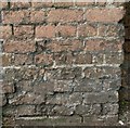
Bench mark, railway bridge, Chandos Street
See http://www.geograph.org.uk/photo/5024104 for location.
Image: © Alan Murray-Rust
Taken: 4 Jul 2016
0.14 miles
6
Railway bridge, Emerys Road
Image: © JThomas
Taken: 15 Mar 2010
0.15 miles
7
Railway bridge, Chandos Street
As built, the bridge simply catered for a farm track, and was never enlarged when Chandos Street and later Emerys Road were created. It still has no footway, and from this side approaching traffic has no real view through.
There is a bench mark http://www.geograph.org.uk/photo/5024106 on the pier at the end of the left hand abutment.
Image: © Alan Murray-Rust
Taken: 4 Jul 2016
0.15 miles
8
Looking east from carlton Station
On the Nottingham to Lincoln line. The station was formerly called Carlton and Netherfield and is in Netherfield rather than Carlton. The renaming distinguishes it from Netherfield Station, formerly Netherfield and Colwick.
Image: © Alan Murray-Rust
Taken: 2 Feb 2009
0.15 miles
9
Burton Road Recreation Ground
Football in winter, cricket in the summer
Image: © Alan Murray-Rust
Taken: 8 May 2008
0.15 miles
10
Shade and shape ? 2
Skateboard park in Jubilee Park recreation ground.
Image: © Alan Murray-Rust
Taken: 17 Dec 2020
0.16 miles


