1
Looking east from carlton Station
On the Nottingham to Lincoln line. The station was formerly called Carlton and Netherfield and is in Netherfield rather than Carlton. The renaming distinguishes it from Netherfield Station, formerly Netherfield and Colwick.
Image: © Alan Murray-Rust
Taken: 2 Feb 2009
0.07 miles
2
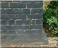
Bench mark, Bridge over the Ouse Dyke, Chandos Street
See http://www.geograph.org.uk/photo/5024100 for location.
Image: © Alan Murray-Rust
Taken: 4 Jul 2016
0.10 miles
3
Bridge over the Ouse Dyke, Chandos Street
The road rises considerably to cross what is quite a small stream. There is a bench mark http://www.geograph.org.uk/photo/5024102on the parapet to the left.
Image: © Alan Murray-Rust
Taken: 4 Jul 2016
0.10 miles
4
Conway Street Recreation Ground
The entrance on Conway Road
Image: © Alan Murray-Rust
Taken: 8 May 2008
0.12 miles
5
Conway Street Recreation Ground
A council-owned facility with well maintained bowling greens and tennis courts
Image: © Alan Murray-Rust
Taken: 8 May 2008
0.12 miles
6
Conway Crescent
A quiet backwater of tween-wars housing on the garden suburb principle.
Image: © Alan Murray-Rust
Taken: 8 May 2008
0.15 miles
7
Carlton Station: eastbound platform
This is the former Midland Railway line to Newark and Lincoln. The platforms at Carlton (formerly Carlton & Netherfield) are staggered rather than opposite each other - the westbound platform is behind the camera, on the other side of the level crossing. The waiting shelter stands on the site of the pretty cottage-style station building, demolished in the 1960s.
Image: © John Sutton
Taken: 22 Aug 2013
0.17 miles
8
Housing on Cross Street, Gedling
The house at this end of the terrace appears to have been a corner shop in the past.
Image: © Richard Vince
Taken: 11 Feb 2014
0.18 miles
9
Dunstan Street, Netherfield
Image: © Richard Vince
Taken: 11 Feb 2014
0.18 miles
10
Carlton Station
Due to space considerations, the station has always been laid out with staggered platforms.
Image: © Alan Murray-Rust
Taken: 17 Dec 2020
0.19 miles


