IMAGES TAKEN NEAR TO
Sands Close, NOTTINGHAM, NG4 2GZ
Introduction
This page details the photographs taken nearby to Sands Close, NG4 2GZ by members of the Geograph project.
The Geograph project started in 2005 with the aim of publishing, organising and preserving representative images for every square kilometre of Great Britain, Ireland and the Isle of Man.

There are currently over 7.5m images from over14,400 individuals and you can help contribute to the project by visiting https://www.geograph.org.uk
Image Map
Images are licensed for reuse under creativecommons.org/licenses/by-sa/2.0
Notes
- Clicking on the map will re-center to the selected point.
- The higher the marker number, the further away the image location is from the centre of the postcode.
Image Listing (46 Images Found)
Images are licensed for reuse under creativecommons.org/licenses/by-sa/2.0
Image
Details
Distance
1
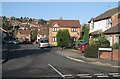
Lawrence Avenue, Colwick.
The Lawrence furniture factory was a major landmark in the area, now replaced by this housing development; the name lives on.
Image: © Alan Murray-Rust
Taken: 14 Jan 2007
0.01 miles
2
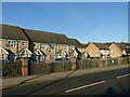
Modern housing on Vale Road
Late 20th century housing on a former industrial site.
Image: © Alan Murray-Rust
Taken: 25 Dec 2020
0.02 miles
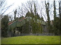
3
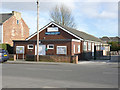
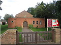
Colwick Village Hall
The Nottingham suburb of Colwick is rediscovering itself as a village community, and was awarded village status in 2008.
Image: © Alan Murray-Rust
Taken: 16 Mar 2014
0.08 miles
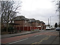
4
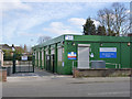
The Colwick Vale Surgery
Looking more like a set of contractors' buildings than a medical centre.
Image: © Alan Murray-Rust
Taken: 16 Mar 2014
0.09 miles
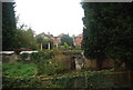
7
Tin Bridge, Colwick
The Tin Bridge, as it is colloquially known, crosses the former Midland Railway line east from Nottingham, providing a pedestrian link between Colwick and Bakersfield. The steps at either end of the bridge have been fitted with very narrow chutes to enable bicycles to be wheeled rather than carried.
Image: © Richard Vince
Taken: 13 Apr 2013
0.10 miles
8
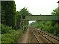
Footbridge at Carlton
This footbridge crosses the rail-line at Carlton, on the edge of Colwick Woods.
Image: © Donnylad
Taken: 2 Jun 2007
0.11 miles
9
The church of St. John the Baptist, Colwick
The modern replacement for Image
Image: © Jonathan Thacker
Taken: 1 Sep 2019
0.11 miles
10
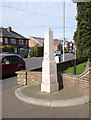
Colwick War Memorial
Erected in 2010 outside St John the Baptist Church as a visible memorial for what is now designated as Colwick village. A simple obelisk in Portland stone, it commemorates all who have given their lives in conflict without reference to particular events.
Image: © Alan Murray-Rust
Taken: 16 Mar 2014
0.11 miles