
IMAGES TAKEN NEAR TO
Knight Street, NOTTINGHAM, NG4 2FN
Introduction
This page details the photographs taken nearby to Knight Street, NG4 2FN by members of the Geograph project.
The Geograph project started in 2005 with the aim of publishing, organising and preserving representative images for every square kilometre of Great Britain, Ireland and the Isle of Man.

There are currently over 7.5m images from over14,400 individuals and you can help contribute to the project by visiting https://www.geograph.org.uk
Image Map
Images are licensed for reuse under creativecommons.org/licenses/by-sa/2.0
Notes
- Clicking on the map will re-center to the selected point.
- The higher the marker number, the further away the image location is from the centre of the postcode.
Image Listing (48 Images Found)
Images are licensed for reuse under creativecommons.org/licenses/by-sa/2.0
Image
Details
Distance
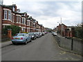
2
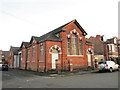
Former chapel, Ashwell Street
Now in commercial use.
Image: © Jonathan Thacker
Taken: 7 Dec 2015
0.05 miles
3
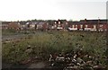
Derelict site close to Netherfield Town Centre
This was the site of Ashwell Street School.
Image: © Jonathan Thacker
Taken: 7 Dec 2015
0.06 miles
4
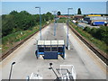
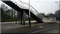
Netherfield railway station
Opened in 1878 by the Great Northern Railway on its line from Grantham to Nottingham. View E towards Grantham, from the approach steps.
Image: © Nigel Thompson
Taken: 24 Jun 2009
0.08 miles
5
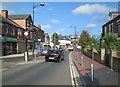
Netherfield: traffic calming in Victoria Road
Near the centre of a suburb which developed round the Great Northern Railway engine shed and marshalling yards in the last quarter of the 19th century.
Image: © John Sutton
Taken: 22 Aug 2013
0.09 miles
6
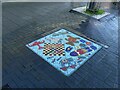
Victoria Street, Netherfield ? Mosaic 1
Featuring children's games and toys. See http://www.geograph.org.uk/photo/6709013 for location.
Image: © Alan Murray-Rust
Taken: 17 Dec 2020
0.09 miles
8
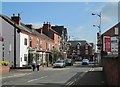
Netherfield: Meadow Road
Looking towards the junction with Victoria Road, the centre of a settlement which mushroomed in the late 19th century around the huge Colwick engine shed and marshalling yards.
Image: © John Sutton
Taken: 22 Aug 2013
0.09 miles
9
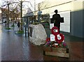
Netherfield War Memorial
Specifically related to World War 1, it was inaugurated as recently as 2019 to mark the centenary of the end of the war in 1919.
Image: © Alan Murray-Rust
Taken: 17 Dec 2020
0.09 miles
10
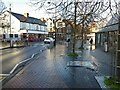
Victoria Street, Netherfield
The area has been an important local centre with retail following the development of the Colwick railway yards. Improvements to landscaping, including the pavement mosaics http://www.geograph.org.uk/photo/6709009 http://www.geograph.org.uk/photo/6709011 , were carried out around 2000.
Image: © Alan Murray-Rust
Taken: 17 Dec 2020
0.09 miles