IMAGES TAKEN NEAR TO
Hotspur Drive, NOTTINGHAM, NG4 2BS

Introduction

This page details the photographs taken nearby to Hotspur Drive, NG4 2BS by members of the Geograph project.

The Geograph project started in 2005 with the aim of publishing, organising and preserving representative images for every square kilometre of Great Britain, Ireland and the Isle of Man.

There are currently over 7.5m images from over14,400 individuals and you can help contribute to the project by visiting https://www.geograph.org.uk

Image Map


Images are licensed for reuse under creativecommons.org/licenses/by-sa/2.0
Notes
  • Clicking on the map will re-center to the selected point.
  • The higher the marker number, the further away the image location is from the centre of the postcode.

Image Listing (34 Images Found)

Images are licensed for reuse under creativecommons.org/licenses/by-sa/2.0
  • ...
Image
Details
Distance
1
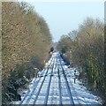
Netherfield Junction
A snowy view from the footbridge at the bottom of Douglas Avenue.
Image: © Alan Murray-Rust Taken: 25 Jan 2021
0.05 miles
2
Lines diverge
Image: © N Chadwick Taken: 29 Oct 2014
0.06 miles
3
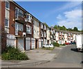
Hotspur Drive, Netherfield
Late 20th century housing development on former industrial land.
Image: © Alan Murray-Rust Taken: 23 May 2021
0.08 miles
4
The Elms
Image: © N Chadwick Taken: 29 Oct 2014
0.10 miles
5
Looking east from the 'Tin Bridge' ? 2020
The same viewpoint as https://www.geograph.org.uk/photo/3902719 . On that picture I commented about the position of the former GNR lines being identified by lower tree growth. These trees have now grown to a height which means that difference is no longer identifiable. The view can only be obtained by holding the camera above the 2 metre high solid parapet of the footbridge.
Image: © Alan Murray-Rust Taken: 25 Dec 2020
0.13 miles
6
Midland Wood Cycle Route
The wood doesn't have a name on any OS mapping, and the name may have been invented when the path was improved as a cycleway in recent times. The path follows a narrow strip between the railway on the right and the steep scarp on the left, colonised by traditional broadleaf woodland and representing the edge of the River Trent's alluvial plain.
Image: © Alan Murray-Rust Taken: 17 Dec 2020
0.13 miles
7
Gamston Lodge
Image: © Andrew Tatlow Taken: 1 Oct 2011
0.13 miles
8
Belvoir Lodge
Modern terraced houses.
Image: © Andrew Tatlow Taken: 1 Oct 2011
0.16 miles
9
Flying school?
This Short 360 aeroplane was installed at St John the Baptist C of E School in Colwick as an additional classroom in 2011. Registered G-SSWD it was once operated by the Exeter based Streamline Airways.
Image: © Alan Murray-Rust Taken: 16 Mar 2014
0.16 miles
10
West from Netherfield
A view from the bridge which carries Chaworth Road over Netherfield Station, with Colwick Woods on the skyline. This is the Great Northern Line from Grantham, which originally ran parallel to and to the south of the Midland line from Newark and Lincoln, which it now joins, as far as Trent Lane. The signal box on the left (a 1960 replacement for the original) is surplus to requirements following the resignalling of Nottingham Midland Station and its approaches. The red-brick house to the right was once the Netherfield & Colwick Stationmaster's House.
Image: © John Sutton Taken: 22 Aug 2013
0.17 miles
  • ...