
IMAGES TAKEN NEAR TO
Eastdale Road, NOTTINGHAM, NG3 7GE
Introduction
This page details the photographs taken nearby to Eastdale Road, NG3 7GE by members of the Geograph project.
The Geograph project started in 2005 with the aim of publishing, organising and preserving representative images for every square kilometre of Great Britain, Ireland and the Isle of Man.

There are currently over 7.5m images from over14,400 individuals and you can help contribute to the project by visiting https://www.geograph.org.uk
Image Map
Images are licensed for reuse under creativecommons.org/licenses/by-sa/2.0
Notes
- Clicking on the map will re-center to the selected point.
- The higher the marker number, the further away the image location is from the centre of the postcode.
Image Listing (43 Images Found)
Images are licensed for reuse under creativecommons.org/licenses/by-sa/2.0
Image
Details
Distance
1
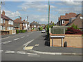
Northdale Road
Virtually the roads in this area incorporate -dale in their name. This is Northdale Road seen from Sunnydale Road. The whole area is typical tween-wars suburbia.
Image: © Alan Murray-Rust
Taken: 20 Jun 2008
0.07 miles
2
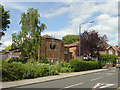
Dales Church
United Reformed Church on Parkdale Road. A relatively modern but nondescript building.
Image: © Alan Murray-Rust
Taken: 20 Jun 2008
0.09 miles
3
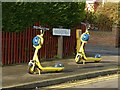
No-one's gone with the Wind
Hireable scooters waiting for customers. Wind electric scooters are an initiative by Nottingham City Council – available for hire via an app on your smartphone.
Image: © Alan Murray-Rust
Taken: 25 Dec 2020
0.11 miles
4
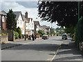
Sunnydale Road
Looking towards Parkdale Road
Image: © Alan Murray-Rust
Taken: 20 Jun 2008
0.12 miles
5
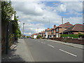
Parkdale Road looking north-east
Most of the roads in this area are 'dales'
Image: © Alan Murray-Rust
Taken: 20 Jun 2008
0.13 miles
6
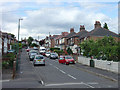
Rosedale Road
Looking up from Oakdale Road to Parkdale Road. Most of the local road names end in -dale.
Image: © Alan Murray-Rust
Taken: 20 Jun 2008
0.14 miles
7
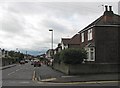
Bakersfield: Greendale Road
Part of the inter-wars eastward expansion of the city. This is the hillier part of Nottingham (about 85m/278ft above sea level here), with views southwards over the Trent Valley to the Vale of Belvoir.
Image: © John Sutton
Taken: 10 May 2012
0.16 miles
8
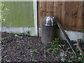
Carlton U D C boundary post
One of a pair (see http://www.geograph.org.uk/photo/3902681) at the southern end of the Carlton Hill Recreation Ground. The post is the same design as those of Nottingham City Council, who share this boundary. Although the boundary was established in 1933 when parts of Carlton were taken into the city, the Carlton posts are for some reason dated 1935. See http://www.geograph.org.uk/photo/3902733 for location.
Image: © Alan Murray-Rust
Taken: 16 Mar 2014
0.16 miles
9
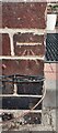
Benchmark on NW corner of #5 Greendale Road
Ordnance Survey cut mark benchmark levelled at 85.670m above Newlyn Datum in 1962
Image: © Roger Templeman
Taken: 26 Sep 2022
0.17 miles
10
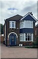
#5 Greendale Road
There is an Ordnance Survey benchmark Image on the left hand side of the house at its front corner
Image: © Roger Templeman
Taken: 26 Sep 2022
0.17 miles