
IMAGES TAKEN NEAR TO
Sneinton Dale, NOTTINGHAM, NG3 7DW
Introduction
This page details the photographs taken nearby to Sneinton Dale, NG3 7DW by members of the Geograph project.
The Geograph project started in 2005 with the aim of publishing, organising and preserving representative images for every square kilometre of Great Britain, Ireland and the Isle of Man.

There are currently over 7.5m images from over14,400 individuals and you can help contribute to the project by visiting https://www.geograph.org.uk
Image Map
Images are licensed for reuse under creativecommons.org/licenses/by-sa/2.0
Notes
- Clicking on the map will re-center to the selected point.
- The higher the marker number, the further away the image location is from the centre of the postcode.
Image Listing (24 Images Found)
Images are licensed for reuse under creativecommons.org/licenses/by-sa/2.0
Image
Details
Distance
1
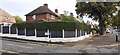
#337 Sneinton Dale at Hemswell Close junction
Ordnance Survey documents indicate that a benchmark levelled at 49.743m above Newlyn Datum was verified in 1962 on the west angle of the house
Image: © Roger Templeman
Taken: 26 Sep 2022
0.08 miles
2
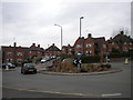
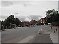
Roundabout in Bakersfield
This roundabout, at the east end of Sneinton Dale, was once used to turn buses on Nottingham City Transport route 34, a shortworking of the Bakersfield service that, latterly at least, operated only as and when required. The housing visible here is typical 1930s Nottingham council housing. From the left, the roads are Sneinton Dale, Linton Rise, Cardale Road, and (just visible in the foreground) Oakdale Road. Watson Avenue is just out of frame to the right.
Image: © Richard Vince
Taken: 13 Apr 2013
0.09 miles
3
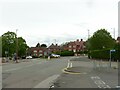
Five Ways Island
Recreating this 'First' for the square https://www.geograph.org.uk/photo/43308 . There has been virtually no subsequent change other than the removal of one of the large trees to the right of the picture.
Image: © Alan Murray-Rust
Taken: 23 May 2021
0.09 miles
4
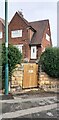
#121 Cardale Road at Oakdale Road junction
Ordnance Survey documents indicate that a benchmark levelled at 60.692m above Newlyn Datum was verified in 1962 on the corner of the house right of the front door
Image: © Roger Templeman
Taken: 26 Sep 2022
0.11 miles
6
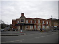
Former pub, Oakdale Road, Bakersfield
Like a number of closed pubs in the Nottingham area, this sizable building at the west end of Oakdale Road had been converted into a small Tesco supermarket. I can't recall the name of the pub, unfortunately; if you know, please tell me.
Image: © Richard Vince
Taken: 13 Apr 2013
0.13 miles
7
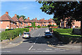
Sneinton Dale: Ipswich Circus
Nottingham built council houses in Garden City style all over the city.
Image: © John Sutton
Taken: 4 Jul 2016
0.14 miles
8
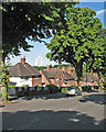
Greenwood Road
Council houses on the hilly eastern side of Nottingham, with the Windmill Lane tower block in the distance.
Image: © John Sutton
Taken: 4 Jul 2016
0.15 miles
9
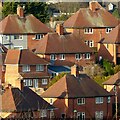
Nottingham roofscape
Classic Nottingham City Council council houses of the inter-war period, with hipped roofs and central chimney stack.
Image: © Alan Murray-Rust
Taken: 25 Dec 2020
0.15 miles
10
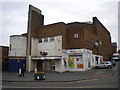
Former cinema, Oakdale Road, Bakersfield
Located near the west end of Oakdale Road, at its junction with Jarvis Avenue (right), this former cinema is now occupied by a convenience store sized branch of the Nisa supermarket chain.
Image: © Richard Vince
Taken: 13 Apr 2013
0.16 miles