IMAGES TAKEN NEAR TO
Mapperley Plains, NOTTINGHAM, NG3 5RY
Introduction
This page details the photographs taken nearby to Mapperley Plains, NG3 5RY by members of the Geograph project.
The Geograph project started in 2005 with the aim of publishing, organising and preserving representative images for every square kilometre of Great Britain, Ireland and the Isle of Man.

There are currently over 7.5m images from over14,400 individuals and you can help contribute to the project by visiting https://www.geograph.org.uk
Image Map
Images are licensed for reuse under creativecommons.org/licenses/by-sa/2.0
Notes
- Clicking on the map will re-center to the selected point.
- The higher the marker number, the further away the image location is from the centre of the postcode.
Image Listing (18 Images Found)
Images are licensed for reuse under creativecommons.org/licenses/by-sa/2.0
Image
Details
Distance
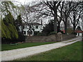
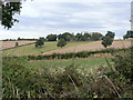
2
Arnold Lodge
Recreating this 'First' for the square https://www.geograph.org.uk/photo/34213. Taken from the public highway, rather further away from the house than the original.
Image: © Alan Murray-Rust
Taken: 18 Jan 2023
0.02 miles
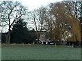
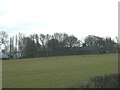
3
Arnold Lodge
Viewed from the B684 near Dorket Head.
Image: © Alan Murray-Rust
Taken: 21 Aug 2011
0.04 miles
4
Arnold Lodge
Seen from the footpath from Dorket Head through Woodborough Park.
Image: © Alan Murray-Rust
Taken: 21 Aug 2011
0.05 miles
5
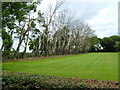
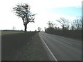
Death Row
This line of trees are all dead, at Arnold Lodge.
Image: © cris sloan
Taken: 4 Jul 2007
0.05 miles
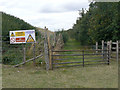
6
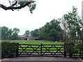
Gate onto land next to Arnold Lodge
A gate that leads onto the road from land next to Arnold Lodge. Most probably for farm vehicles.
Image: © James Hill
Taken: 7 Jun 2007
0.11 miles
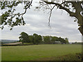
8
Footpath alongside the clay pit
The path is the diverted route of a path which crossed the area covered by the clay pit.
Image: © Alan Murray-Rust
Taken: 21 Aug 2011
0.14 miles
9
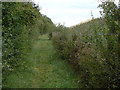
Footpath alongside the clay pit
The path is the diverted route of a path which crossed the area covered by the clay pit.
Image: © Alan Murray-Rust
Taken: 21 Aug 2011
0.15 miles