1
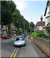
Junction of Redcliffe Road and Zulla Road
Redcliffe Road (centre) is one of the more significant roads through Mapperley Park, while Zulla Road (left foreground) parallels Mansfield Road for about a quarter of a mile, passing the backs of a few hotels.
Image: © Richard Vince
Taken: 12 Apr 2010
0.01 miles
2
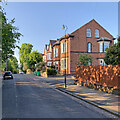
Up Redcliffe Road
Redcliffe Road leads uphill through the southern end of Mapperley Park from Mansfield Road to Woodborough Road (ahead). Zulla Road is to the left and Thorncliffe Road to the right in this picture taken on a cloudless May evening.
Image: © John Sutton
Taken: 20 May 2023
0.01 miles
3
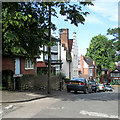
View south along Zulla Road
Redcliffe Road crosses the end of Zulla Road (see
Image), with Thorncliffe Road just visible on the other side. The tower of St Andrew's church, on the corner of Mansfield Road and Mapperley Road, is visible on the horizon. The gateway to the right of the car leads to the car park of a large Park Inn hotel that fronts onto Mansfield Road.
Image: © Richard Vince
Taken: 12 Apr 2010
0.02 miles
4
Houses on Thorncliffe Road
Image: © Jonathan Thacker
Taken: 15 Jan 2016
0.02 miles
5
Mapperley Park: Thorncliffe Road
Substantial Edwardian houses at the Redcliffe Road end of Thorncliffe Road.
Image: © John Sutton
Taken: 6 Jul 2015
0.03 miles
6
Up Zulla Road
Looking north from near the junction with Redcliffe Road on a clear May evening.
Image: © John Sutton
Taken: 20 May 2023
0.03 miles
7
Mapperley Park: on Thorncliffe Road
A rendered Edwardian house with an Arts and Crafts look to it. The houses of Mapperley Park attest to the prosperity of late-Victorian and Edwardian Nottingham.
Image: © John Sutton
Taken: 6 Jul 2015
0.05 miles
8
Nottingham, NG3 - Clarendon College Area
With the Gregory Boulevard/Mansfield Road roundabout behind the photographer this is a view along the first 100 metres of so of Redcliffe Road. This connection with Mapperley Road was known as Red Lane until approximately 1870. Prior to this under, the Inclosure Act of 1792, all the land from Redcliffe Lane (Red Lane) up as far as the Private Road estate and from Mansfield Road to the St.Jude's Church boundary was allotted to Mr Ichabod Wright, who gave the land upon which St John's (Anglican) Church, Carrington was built.
Image: © David Hallam-Jones
Taken: 4 Nov 2012
0.06 miles
9
Mansfield Road at Redcliffe Road
Taken to show the location of the boundary marker seen here http://www.geograph.org.uk/photo/3903436 , visible on the corner.
Image: © Alan Murray-Rust
Taken: 18 Mar 2014
0.06 miles
10
Down Thorncliffe Rise
The edge of Mapperley Park, on the hillier east side of Nottingham. Thorncliffe Road is at the bottom of the road.
Image: © John Sutton
Taken: 6 Jul 2015
0.06 miles


