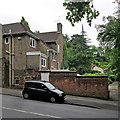
IMAGES TAKEN NEAR TO
Mapperley Road, NOTTINGHAM, NG3 5AQ

Introduction

This page details the photographs taken nearby to Mapperley Road, NG3 5AQ by members of the Geograph project.

The Geograph project started in 2005 with the aim of publishing, organising and preserving representative images for every square kilometre of Great Britain, Ireland and the Isle of Man.

There are currently over 7.5m images from over14,400 individuals and you can help contribute to the project by visiting https://www.geograph.org.uk

Image Map


Images are licensed for reuse under creativecommons.org/licenses/by-sa/2.0
Notes
  • Clicking on the map will re-center to the selected point.
  • The higher the marker number, the further away the image location is from the centre of the postcode.

Image Listing (147 Images Found)

Images are licensed for reuse under creativecommons.org/licenses/by-sa/2.0
  • ...
Image
Details
Distance
1
Benchmark on wall of Mapperley Road
Ordnance Survey cut mark benchmark described on the Bench Mark Database at http://www.bench-marks.org.uk/bm47884
Image: © Roger Templeman Taken: 31 Mar 2013
0.02 miles
2
Mapperley Road
There is an OS benchmark Image on the stone wall about 3m left of the lamp post
Image: © Roger Templeman Taken: 31 Mar 2013
0.02 miles
3
Lodge and stables, Mapperley Road, Nottingham
Muscular Victoriana, possibly by Henry Sulley, 1874, and originally associated with Image The gatepiers could scarcely be more Gothic. Grade II listed.
Image: © Stephen Richards Taken: 19 Jun 2015
0.03 miles
4
On Redcliffe Road
The picture gives an idea of how steep this road which links Mansfield Road and Mapperley and Woodborough Roads is. In the distance on the right is a grand, rather Germanic-looking house, higher up on Mapperley Road.
Image: © John Sutton Taken: 15 Jun 2014
0.04 miles
5
The top of Redcliffe Road
Redcliffe Road drops steeply from Mapperley Road to Mansfield Road and there are huge Bulwell stone retaining walls at the corner near the top end. Alan Murray-Rust's Image] is a view up the hill. The photograph was taken on an especially overcast Sunday morning in June.
Image: © John Sutton Taken: 15 Jun 2014
0.04 miles
6
"Beechwood"
A Watson Fothergill house on Mapperley Road, dating from 1904.
Image: © David Lally Taken: 6 May 2010
0.05 miles
7
"Beechwood"
A house by Watson Fothergill, from 1904.
Image: © David Lally Taken: 6 May 2010
0.05 miles
8
Retaining wall, Redcliffe Road
A fine piece of mid/late 19th century masonry in the local (possibly Bulwell) stone.
Image: © Alan Murray-Rust Taken: 18 Mar 2014
0.05 miles
9
Redcliffe Road approaching Mapperley Road junction
Image: © Roger Templeman Taken: 1 Apr 2013
0.05 miles
10
Nottingham boundary marker (1869)
Image: © SK53 Taken: 24 May 2011
0.05 miles
  • ...