1
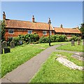
Chapel Street, Ruskington
The Beck by Chapel Street. The beck runs eastwards through the town then heads south-east to the railway line, eventually draining into the River Slea.
Image: © Dave Hitchborne
Taken: 26 Aug 2013
0.01 miles
2
All Saints' church, Ruskington, Lincs.
The tower was rebuilt in 1620 after the medieval tower fell down in 1618, inside a Norman tower arch and Decorated arcades and some Early English windows in the chancel.
Image: © Richard Croft
Taken: 8 May 2006
0.02 miles
3
All Saints Church Ruskington
Image: © Steve Drury
Taken: 25 Nov 2012
0.02 miles
4
The Church of All Saints, Ruskington
Lamp post by the churchyard path.
Image: © Dave Hitchborne
Taken: 26 Aug 2013
0.02 miles
5
The Close, 4 and 6 Chapel Street, Ruskington
Grade II Listed late 18th century house now two cottages.
Image: © Jo and Steve Turner
Taken: 26 Apr 2021
0.02 miles
6
The Close, Ruskington
Cottages abutting the churchyard https://historicengland.org.uk/listing/the-list/list-entry/1254212
Image: © Jonathan Thacker
Taken: 28 Aug 2021
0.02 miles
7
Chapel Street, Ruskington
Footbridge over The Beck - http://www.geograph.org.uk/photo/3629168 It leads to All Saints churchyard.
Image: © Dave Hitchborne
Taken: 26 Aug 2013
0.03 miles
8
Wesleyan Methodist Chapel, Ruskington
Ruskington's, Chapel Street Chapel (Wesleyan Methodist) The first Wesleyan Methodist chapel in Ruskington was built in 1833. It was replaced by a new chapel on Chapel Street in 1849, which was rebuilt in 1958.
Image: © Dave Hitchborne
Taken: 26 Aug 2013
0.03 miles
9
Churchside House
18th century house by All Saints' church
Image: © Richard Croft
Taken: 23 Feb 2008
0.03 miles
10
18th Century Houses, Ruskington
The 18th century houses sit next to the border of All Saints churchyard.
Image: © Dave Hitchborne
Taken: 26 Aug 2013
0.03 miles


