IMAGES TAKEN NEAR TO
Leasingham Lane, SLEAFORD, NG34 9AQ
Introduction
This page details the photographs taken nearby to Leasingham Lane, NG34 9AQ by members of the Geograph project.
The Geograph project started in 2005 with the aim of publishing, organising and preserving representative images for every square kilometre of Great Britain, Ireland and the Isle of Man.

There are currently over 7.5m images from over14,400 individuals and you can help contribute to the project by visiting https://www.geograph.org.uk
Image Map
Images are licensed for reuse under creativecommons.org/licenses/by-sa/2.0
Notes
- Clicking on the map will re-center to the selected point.
- The higher the marker number, the further away the image location is from the centre of the postcode.
Image Listing (17 Images Found)
Images are licensed for reuse under creativecommons.org/licenses/by-sa/2.0
Image
Details
Distance
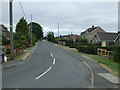
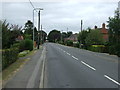
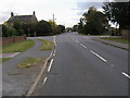
2
Leasingham Lane, Ruskington
Looking south.
Image: © Julian P Guffogg
Taken: 19 Apr 2018
0.06 miles
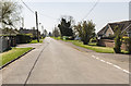
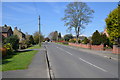
3
Leasingham Lane
Leasingham Lane passing Moor Park
Image: © Shaun Ferguson
Taken: 12 Oct 2009
0.07 miles
4
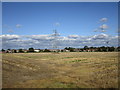
Stubble field on the edge of Ruskington
Image: © Jonathan Thacker
Taken: 2 Oct 2019
0.09 miles
5
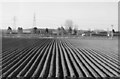
Potato field, Lincolnshire
Newly planted potato field on Leasingham lane in Ruskington.
Image: © Joanne Davies
Taken: 2 Apr 2006
0.09 miles
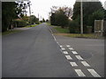
6
Rectory Road (B1188), Ruskington
Heading east.
Image: © JThomas
Taken: 20 Jul 2013
0.11 miles
7
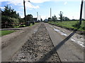
Rough Road in Ruskington
This road in Ruskington is a case of work in progress.
Image: © Michael Patterson
Taken: 9 Oct 2006
0.14 miles
8
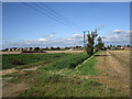
Drain, power line and track, Ruskington
Image: © Jonathan Thacker
Taken: 2 Oct 2019
0.14 miles
9
Lincoln Road
Lincoln Road at crossroads with Manor Street and Westcliffe Road
Image: © Shaun Ferguson
Taken: 12 Oct 2009
0.17 miles
10
Manor Street, Ruskington
Towards its junction with the B1188 Lincoln Road.
Image: © Julian P Guffogg
Taken: 13 Apr 2016
0.18 miles