
IMAGES TAKEN NEAR TO
Hengist Close, SLEAFORD, NG34 8WU
Introduction
This page details the photographs taken nearby to Hengist Close, NG34 8WU by members of the Geograph project.
The Geograph project started in 2005 with the aim of publishing, organising and preserving representative images for every square kilometre of Great Britain, Ireland and the Isle of Man.

There are currently over 7.5m images from over14,400 individuals and you can help contribute to the project by visiting https://www.geograph.org.uk
Image Map
Images are licensed for reuse under creativecommons.org/licenses/by-sa/2.0
Notes
- Clicking on the map will re-center to the selected point.
- The higher the marker number, the further away the image location is from the centre of the postcode.
Image Listing (23 Images Found)
Images are licensed for reuse under creativecommons.org/licenses/by-sa/2.0
Image
Details
Distance
1
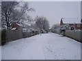
Footpath in the snow
Looking in an easterly direction along the public footpath which skirts around the housing estate.
Image: © Ian Paterson
Taken: 18 Dec 2009
0.10 miles
2
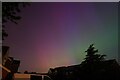
Home entertainment
The magnificent Aurora Borealis seen from my 'pop-up' home observatory. No flight to Iceland this time.
Glorious!
Image: © Ian Paterson
Taken: 11 May 2024
0.15 miles
3
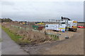
Contractor's compound
Pitched up near the small copse begins the compound and hard standing ahead of the new housing development at Stump Cross Hill. It had been like the photo here since March 2017 Image
Image: © Ian Paterson
Taken: 14 Feb 2018
0.16 miles
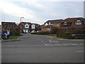
5
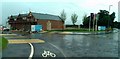
Co-op opening soon
Work continues at the new development in London Road with the nearing-completion of the new Co-op store.
Image: © Ian Paterson
Taken: 10 Jun 2019
0.17 miles
6
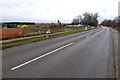
Started at last
The new housing development appears to be getting under way after almost a year of inactivity since the first signs of something happening Image
Image: © Ian Paterson
Taken: 14 Feb 2018
0.17 miles
7
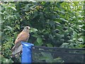
Raptor in the Garden
This kestrel had just reduced a pigeon to bone and feather and was clearly too full to fly away from the trampoline perch.
Image: © Ian Paterson
Taken: 23 Jun 2009
0.18 miles
8
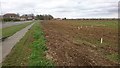
New road staked out
Wooden pegs mark out the position of the road leading to the new housing estate planned for this site.
Image: © Ian Paterson
Taken: 29 Mar 2017
0.18 miles
9
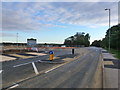
Opening up
The new housing development has removed some of the potholes in the road!
Compare with Image
Image: © Ian Paterson
Taken: 7 Sep 2018
0.18 miles
10
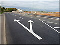
New road markings. Will they help?
Let's hope the narrower gap after the right turn will help reduce the top speed from 60 mph along this 30 mph stretch of road. Much better than nasty speed bumps!
Image: © Ian Paterson
Taken: 7 Sep 2018
0.18 miles