IMAGES TAKEN NEAR TO
Aswarby, SLEAFORD, NG34 8SA
Introduction
This page details the photographs taken nearby to NG34 8SA by members of the Geograph project.
The Geograph project started in 2005 with the aim of publishing, organising and preserving representative images for every square kilometre of Great Britain, Ireland and the Isle of Man.

There are currently over 7.5m images from over14,400 individuals and you can help contribute to the project by visiting https://www.geograph.org.uk
Image Map
Images are licensed for reuse under creativecommons.org/licenses/by-sa/2.0
Notes
- Clicking on the map will re-center to the selected point.
- The higher the marker number, the further away the image location is from the centre of the postcode.
Image Listing (13 Images Found)
Images are licensed for reuse under creativecommons.org/licenses/by-sa/2.0
Image
Details
Distance
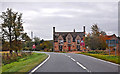
2
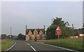
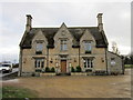
The A15, Aswarby
Looking towards the Tally Ho pub
Image: © David Howard
Taken: 24 Jun 2019
0.01 miles
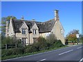
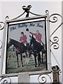
9
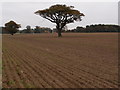
Oak trees in an arable setting
Looking towards the Tally Ho! pub on the A15 from the minor road to Aunsby.
Image: © Michael Trolove
Taken: 30 Oct 2016
0.15 miles
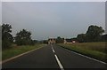
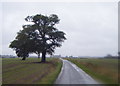
10
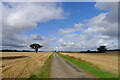
The road to Aunsby
In the Southern Lincolnshire Edge National Character Area https://publications.naturalengland.org.uk/file/6753160429305856 . Wide open farming landscape on the dip slope of the Jurassic escarpment
Image: © Tim Heaton
Taken: 29 Jul 2023
0.19 miles