IMAGES TAKEN NEAR TO
Sellwood Court, SLEAFORD, NG34 8GJ
Introduction
This page details the photographs taken nearby to Sellwood Court, NG34 8GJ by members of the Geograph project.
The Geograph project started in 2005 with the aim of publishing, organising and preserving representative images for every square kilometre of Great Britain, Ireland and the Isle of Man.

There are currently over 7.5m images from over14,400 individuals and you can help contribute to the project by visiting https://www.geograph.org.uk
Image Map
Images are licensed for reuse under creativecommons.org/licenses/by-sa/2.0
Notes
- Clicking on the map will re-center to the selected point.
- The higher the marker number, the further away the image location is from the centre of the postcode.
Image Listing (14 Images Found)
Images are licensed for reuse under creativecommons.org/licenses/by-sa/2.0
Image
Details
Distance
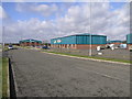
2
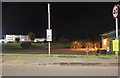
Industrial units, Poplar Businees Park
Image: © Jonathan Thacker
Taken: 3 Dec 2019
0.07 miles
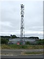
3
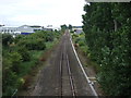
East Gate, Sleaford
Approaching the A17 junction to the left
Image: © David Howard
Taken: 6 Aug 2019
0.10 miles
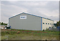
5
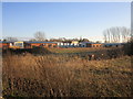
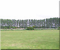
Enterprise Park
Sleaford Enterprise Park is located by the side of the A17 Sleaford by-pass.
Image: © Michael Patterson
Taken: 15 Feb 2006
0.12 miles
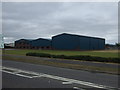
10
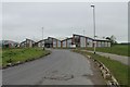
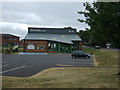
Industrial Units along Pride Parkway
At Sleaford Enterprise Park (not shown on OS Map)
Image: © J.Hannan-Briggs
Taken: 19 May 2012
0.17 miles