IMAGES TAKEN NEAR TO
The Point, Lions Way, SLEAFORD, NG34 8GG
Introduction
This page details the photographs taken nearby to The Point, Lions Way, NG34 8GG by members of the Geograph project.
The Geograph project started in 2005 with the aim of publishing, organising and preserving representative images for every square kilometre of Great Britain, Ireland and the Isle of Man.

There are currently over 7.5m images from over14,400 individuals and you can help contribute to the project by visiting https://www.geograph.org.uk
Image Map
Images are licensed for reuse under creativecommons.org/licenses/by-sa/2.0
Notes
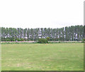
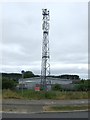
- Clicking on the map will re-center to the selected point.
- The higher the marker number, the further away the image location is from the centre of the postcode.
Image Listing (26 Images Found)
Images are licensed for reuse under creativecommons.org/licenses/by-sa/2.0
Image
Details
Distance
3
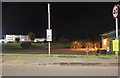
East Gate, Sleaford
Approaching the A17 junction to the left
Image: © David Howard
Taken: 6 Aug 2019
0.07 miles
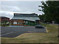
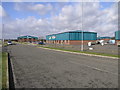
5
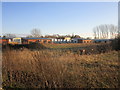
Industrial units, Poplar Businees Park
Image: © Jonathan Thacker
Taken: 3 Dec 2019
0.13 miles
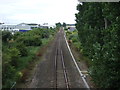
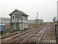
6
Crossing and Box
The level crossing and signal box are at Sleaford North.
Image: © Michael Patterson
Taken: 9 Oct 2006
0.14 miles
8
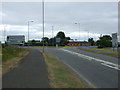
East Road (A153)
Heading south into Sleaford.
Image: © JThomas
Taken: 20 Jul 2013
0.16 miles
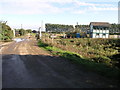
9
Enterprise Park
Sleaford Enterprise Park is located by the side of the A17 Sleaford by-pass.
Image: © Michael Patterson
Taken: 15 Feb 2006
0.16 miles
10
Sleaford North Junction (1)
Formerly a double track junction, but the right hand line, to Sleaford station, is now single track. Southbound trains calling at the station have to use the crossover http://www.geograph.org.uk/photo/4253808 to reach the right line. The signal box was taken out of use in April 2014 when signalling control passed to Lincoln, but was still standing when I visited.
Image: © Alan Murray-Rust
Taken: 19 Nov 2014
0.16 miles