
IMAGES TAKEN NEAR TO
Newstead Street, SLEAFORD, NG34 6AQ
Introduction
This page details the photographs taken nearby to Newstead Street, NG34 6AQ by members of the Geograph project.
The Geograph project started in 2005 with the aim of publishing, organising and preserving representative images for every square kilometre of Great Britain, Ireland and the Isle of Man.

There are currently over 7.5m images from over14,400 individuals and you can help contribute to the project by visiting https://www.geograph.org.uk
Image Map
Images are licensed for reuse under creativecommons.org/licenses/by-sa/2.0
Notes
- Clicking on the map will re-center to the selected point.
- The higher the marker number, the further away the image location is from the centre of the postcode.
Image Listing (33 Images Found)
Images are licensed for reuse under creativecommons.org/licenses/by-sa/2.0
Image
Details
Distance
1
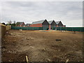
New store under construction
Part of a new neighbourhood being developed off London Road.
Image: © Jonathan Thacker
Taken: 13 Jul 2019
0.05 miles
2
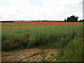
Red Fields from Stump Cross Hill
Looking towards Silk Willoughby across the poppy field from a gap in the hedge at the point where London Road merges into Stump Cross Hill.
Image: © Ian Paterson
Taken: 21 Jun 2009
0.05 miles
3
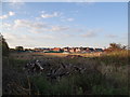
Short walk to the co-op
View of progress of the ongoing development work taken from a convenient corner. The co-op is the building to the left.
Image: © Ian Paterson
Taken: 1 Sep 2020
0.06 miles
4
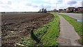
Start of new housing development
Planning consent has been granted, the old hedges have been uprooted and the farmer's field lies unplanted. The speed limit is to be reduced to 30mph and the new road access has been marked out with posts. Wonder when the new houses will start to spring up?
Image: © Ian Paterson
Taken: 21 Mar 2017
0.07 miles
5
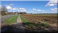
New houses on the horizon
The start of the new housing development on the south east of Sleaford. It's October 2017 now (photo taken in March 2017) and still no sign of any activity on the building front.
Image: © Ian Paterson
Taken: 21 Mar 2017
0.08 miles
6
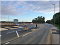
Opening up
The new housing development has removed some of the potholes in the road!
Compare with Image
Image: © Ian Paterson
Taken: 7 Sep 2018
0.08 miles
7
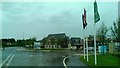
Taking shape
New housing (and Co-op) development on London Road beginning to look less like a construction site as the houses on the frontage are completed, with some already having been sold. Handy for the shop too!
Image: © Ian Paterson
Taken: 10 Jun 2019
0.08 miles
8

New road markings. Will they help?
Let's hope the narrower gap after the right turn will help reduce the top speed from 60 mph along this 30 mph stretch of road. Much better than nasty speed bumps!
Image: © Ian Paterson
Taken: 7 Sep 2018
0.08 miles
9
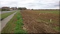
New road staked out
Wooden pegs mark out the position of the road leading to the new housing estate planned for this site.
Image: © Ian Paterson
Taken: 29 Mar 2017
0.08 miles
10

New housing development south of Sleaford: aerial 2025
Image: © Chris
Taken: 8 Jun 2025
0.08 miles