IMAGES TAKEN NEAR TO
West Street, SLEAFORD, NG34 0SW
Introduction
This page details the photographs taken nearby to West Street, NG34 0SW by members of the Geograph project.
The Geograph project started in 2005 with the aim of publishing, organising and preserving representative images for every square kilometre of Great Britain, Ireland and the Isle of Man.

There are currently over 7.5m images from over14,400 individuals and you can help contribute to the project by visiting https://www.geograph.org.uk
Image Map
Images are licensed for reuse under creativecommons.org/licenses/by-sa/2.0
Notes
- Clicking on the map will re-center to the selected point.
- The higher the marker number, the further away the image location is from the centre of the postcode.
Image Listing (300 Images Found)
Images are licensed for reuse under creativecommons.org/licenses/by-sa/2.0
Image
Details
Distance
1
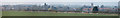
Panorama of Folkingham
Seen from the nearby hilltop is the village of Folkingham. The church of St Andrew with its 4-pinnacled tower is toward the right. A little to the left is the spire of St.Nicholas Church in Walcot, further to the north. To the right of the church can be seen the Greyhound, former coaching inn. The Panorama starts roughly west-nor-west and ends just about due north.
This was stitched from six separate images using Microsoft's ICE, resulting in an image of 23069x4095 pixels. The stitching process introduced a distortion which was corrected using The Gimp, skewing the picture by 161 pixels to the right at the top, to get the church tower and spire upright. It then had to be scaled down to 10173x1500 to fit within the 8Mb file limit for Geograph. Larger versions are available on request.
The individual images were 6480x4320 taken with my Samsun NX500, using the 50..200 lens at 200mm, equivalent to 300mm on a 35mm camera. The camera was using iso ratings between 160 and 200, at f5.6 and 1/500 second.
The day had started very foggy and although there was some bright sunlight a lot of misty haze persisted at ground level.
Image: © Bob Harvey
Taken: 13 Mar 2016
0.02 miles
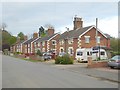
8
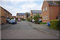
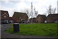
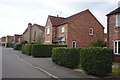
Folkingham housing estate
A cul-de-sak off Churchfields Road
Image: © Bob Harvey
Taken: 14 Apr 2018
0.07 miles
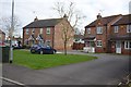
10
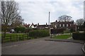
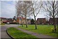
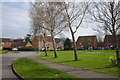
Footpath to the shops
This end of the housing estate is bounded by the Vicaragte garden and a small footpath to the village centre
Image: © Bob Harvey
Taken: 14 Apr 2018
0.08 miles