IMAGES TAKEN NEAR TO
Aslackby, SLEAFORD, NG34 0HW
Introduction
This page details the photographs taken nearby to NG34 0HW by members of the Geograph project.
The Geograph project started in 2005 with the aim of publishing, organising and preserving representative images for every square kilometre of Great Britain, Ireland and the Isle of Man.

There are currently over 7.5m images from over14,400 individuals and you can help contribute to the project by visiting https://www.geograph.org.uk
Image Map
Images are licensed for reuse under creativecommons.org/licenses/by-sa/2.0
Notes
- Clicking on the map will re-center to the selected point.
- The higher the marker number, the further away the image location is from the centre of the postcode.
Image Listing (10 Images Found)
Images are licensed for reuse under creativecommons.org/licenses/by-sa/2.0
Image
Details
Distance


4

Kirkby Underwood Road
Heading north towards Aslackby.
Image: © JThomas
Taken: 12 Oct 2013
0.14 miles
6

Battered ash
By a bend on Kirkby Underwood Road.
Image: © Jonathan Thacker
Taken: 24 Aug 2020
0.16 miles
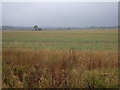
7

The road between Kirkby Underwood and Aslackby
Image: © Tim Heaton
Taken: 24 Jan 2023
0.17 miles
8

Sovereign Street
Towards Kirkby Underwood
Image: © J.Hannan-Briggs
Taken: 8 Apr 2012
0.19 miles
9

Country lane, Aslackby, Lincs
looking NNE towards the village.
Image: © Rodney Burton
Taken: 26 Aug 2006
0.23 miles
10

Kirkby Underwood Road
Lane from Aslackby to Kirkby Underwood
Image: © Richard Croft
Taken: 12 Jul 2012
0.23 miles