IMAGES TAKEN NEAR TO
Lobthorpe, GRANTHAM, NG33 5LR
Introduction
This page details the photographs taken nearby to NG33 5LR by members of the Geograph project.
The Geograph project started in 2005 with the aim of publishing, organising and preserving representative images for every square kilometre of Great Britain, Ireland and the Isle of Man.

There are currently over 7.5m images from over14,400 individuals and you can help contribute to the project by visiting https://www.geograph.org.uk
Image Map
Images are licensed for reuse under creativecommons.org/licenses/by-sa/2.0
Notes
- Clicking on the map will re-center to the selected point.
- The higher the marker number, the further away the image location is from the centre of the postcode.
Image Listing (5 Images Found)
Images are licensed for reuse under creativecommons.org/licenses/by-sa/2.0
Image
Details
Distance
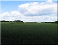
2
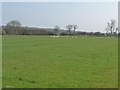
Sheep pasture, west of Woodbine Farm
Just east of the Great North Road [A1].
Image: © Christine Johnstone
Taken: 10 Apr 2015
0.21 miles
3
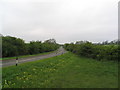
South Witham Nature Reserve
A former railway cutting was converted to a road passing under the A1 (bridge in distance), and the protected verges and banks constitute a Nature Reserve. Abundant cowslips in this May picture
Image: © Tim Heaton
Taken: 14 May 2006
0.21 miles
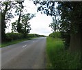
5
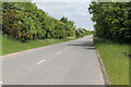
Morkery Lane
Near The South Witham Nature Reserve.
Image: © J.Hannan-Briggs
Taken: 9 Jun 2013
0.25 miles