IMAGES TAKEN NEAR TO
Church Street, GRANTHAM, NG33 5HQ
Introduction
This page details the photographs taken nearby to Church Street, NG33 5HQ by members of the Geograph project.
The Geograph project started in 2005 with the aim of publishing, organising and preserving representative images for every square kilometre of Great Britain, Ireland and the Isle of Man.

There are currently over 7.5m images from over14,400 individuals and you can help contribute to the project by visiting https://www.geograph.org.uk
Image Map
Images are licensed for reuse under creativecommons.org/licenses/by-sa/2.0
Notes
- Clicking on the map will re-center to the selected point.
- The higher the marker number, the further away the image location is from the centre of the postcode.
Image Listing (71 Images Found)
Images are licensed for reuse under creativecommons.org/licenses/by-sa/2.0
Image
Details
Distance
3
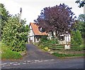
House on Church Street
According to the map the house is nasmed "Tudor House".
Image: © Andrew Tatlow
Taken: 4 Oct 2013
0.06 miles
4
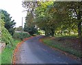
Church Street, Skillington
Heading west from the north end of The Square.
Image: © Christine Johnstone
Taken: 28 Dec 2013
0.07 miles
5
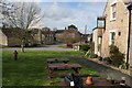
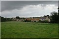
Village centre, Skillington
Skillington has a large open area in the centre with a large village green. There are good vistas down village lanes and streets with plenty of substantial limestone cottages and houses.
The Blue Horse pub had tables out on the green and several people were enjoying the late afternoon April sunshine.
Image: © Kate Jewell
Taken: 22 Apr 2012
0.08 miles
6
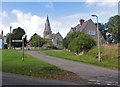
Towards the church
The church is dedicated to St Andrew and St Mary.
Image: © Andrew Tatlow
Taken: 4 Oct 2013
0.09 miles
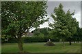
7
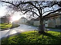
Bench round a tree, Skillington
On a triangle of grass at the north end of The Square.
Image: © Christine Johnstone
Taken: 28 Dec 2013
0.09 miles
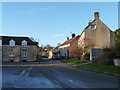
8
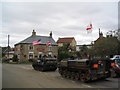
Cross Swords Inn, Skillington
Hopefully no drinking and driving for these customers.
Image: © Tim Heaton
Taken: 2 Sep 2007
0.09 miles
9
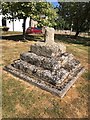
Old Central Cross by Church Street, Skillington
Skillington Cross, old shaft, base and steps by the wayside, in parish of Skillington (South Kesteven District), Church Street.
Grade II listed.
List Entry Number: 1168326 https://historicengland.org.uk/listing/the-list/list-entry/1168326
To be surveyed
Milestone Society National ID: LISK_SKI
Image: © Milestone Society
Taken: Unknown
0.09 miles
10
Cross stump
All that remains of an octagonal village cross, this is still a grade II listed structure: https://www.historicengland.org.uk/listing/the-list/list-entry/1168326
Image: © Bob Harvey
Taken: 28 Aug 2016
0.09 miles