IMAGES TAKEN NEAR TO
Red Cottages, GRANTHAM, NG33 5EQ
Introduction
This page details the photographs taken nearby to Red Cottages, NG33 5EQ by members of the Geograph project.
The Geograph project started in 2005 with the aim of publishing, organising and preserving representative images for every square kilometre of Great Britain, Ireland and the Isle of Man.

There are currently over 7.5m images from over14,400 individuals and you can help contribute to the project by visiting https://www.geograph.org.uk
Image Map
Images are licensed for reuse under creativecommons.org/licenses/by-sa/2.0
Notes
- Clicking on the map will re-center to the selected point.
- The higher the marker number, the further away the image location is from the centre of the postcode.
Image Listing (14 Images Found)
Images are licensed for reuse under creativecommons.org/licenses/by-sa/2.0
Image
Details
Distance
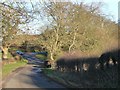
1
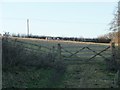
Sheep pasture, north of Red Cottages
On the west side of Grantham Road.
Image: © Christine Johnstone
Taken: 28 Dec 2013
0.05 miles
2
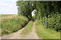
Track towards Cocked Hat Plantation
Image: © J.Hannan-Briggs
Taken: 12 Aug 2012
0.06 miles
4
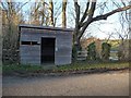
Bus shelter, Grantham Road
Just north of Red Cottages.
Image: © Christine Johnstone
Taken: 28 Dec 2013
0.06 miles
5
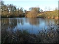
Pond to the west of Grantham Road
East [and downstream] of Brickyard Plantation.
Image: © Christine Johnstone
Taken: 28 Dec 2013
0.08 miles
6
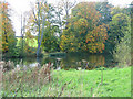
Near Stoke Rochford
Backing onto Brickyard Plantation this small lake is opposite the junction of Cringle Lane and the road from Ponton Heath to Skillington.
Image: © Kate Jewell
Taken: 23 Oct 2005
0.08 miles
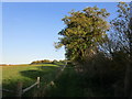
7
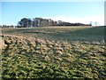
Sheep pasture, east of Grantham Road
On the south side of the fish pond.
Image: © Christine Johnstone
Taken: 28 Dec 2013
0.09 miles
8
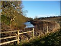
Fencing around the fish pond, west of Stoke Rochford
Alongside Grantham Road.
Image: © Christine Johnstone
Taken: 28 Dec 2013
0.10 miles
9
87 metre spot height, Grantham Road
At the bottom of a steep-sided little valley, between two ponds.
Image: © Christine Johnstone
Taken: 28 Dec 2013
0.10 miles
10
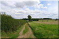
Footpath track down to Red Cottages
A footpath follows the valley from Wyville (SK 884 292) to the road at Red Cottages (SK 908 283), and then on to Stoke Rochford as a bridleway. There is plenty of evidence for it on the ground, but it is not marked as a public right of way on OS maps.
Image: © Tim Heaton
Taken: 20 Aug 2017
0.11 miles