IMAGES TAKEN NEAR TO
Ropsley, GRANTHAM, NG33 4AS
Introduction
This page details the photographs taken nearby to NG33 4AS by members of the Geograph project.
The Geograph project started in 2005 with the aim of publishing, organising and preserving representative images for every square kilometre of Great Britain, Ireland and the Isle of Man.

There are currently over 7.5m images from over14,400 individuals and you can help contribute to the project by visiting https://www.geograph.org.uk
Image Map
Images are licensed for reuse under creativecommons.org/licenses/by-sa/2.0
Notes
- Clicking on the map will re-center to the selected point.
- The higher the marker number, the further away the image location is from the centre of the postcode.
Image Listing (6 Images Found)
Images are licensed for reuse under creativecommons.org/licenses/by-sa/2.0
Image
Details
Distance
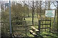
1
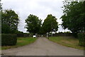
Entrance to South Lodge Farm off Risewood Lane
Image: © Tim Heaton
Taken: 20 Sep 2021
0.16 miles
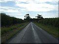
3

Grantham Road near Ropsley
Looking towards Image which can be seen in the centre distance.
Image: © Kate Jewell
Taken: 18 Feb 2007
0.20 miles
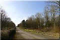
4
Children! Horses! Machinery!
What more entertainment do you need on this footpath to Ropsley?
Image: © J.Hannan-Briggs
Taken: 1 Apr 2012
0.24 miles