1
Hindu Temple, Carlton Road, Nottingham
Image: © JThomas
Taken: 1 Jul 2010
0.06 miles
2
Hindu Community Centre
Image: © Chris Morgan
Taken: 19 Jul 2016
0.07 miles
3
Hindu Temple, Carlton Road
A converted Victorian school
Image: © Alan Murray-Rust
Taken: 11 Feb 2007
0.07 miles
4
Nottingham in the 1980s - Carlton Road
Looking towards the city centre. The Hindu temple was still on the site in 2020 but the Victorian building had been swept away to become its car-park.
Image: © Nigel Thompson
Taken: 2 Feb 1982
0.07 miles
5
Nottingham in the 1980s - Carlton Road
Looking away from the Centre. The large building on the right, at the corner of Hooton Street, was still extant in 2020, as was the takeaway on the left. Beyond the takeaway was the Hindu Temple. It was still there in 2020 but uses a more modern building on the site.
Image: © Nigel Thompson
Taken: 2 Feb 1982
0.09 miles
6
Serlby Rise
Inter-war council housing development off Carlton Road.
Image: © Alan Murray-Rust
Taken: 19 May 2009
0.10 miles
7
St. Matthias' Church, Sneinton
Just after closure.
Image: © Andrew Abbott
Taken: 6 Sep 2008
0.10 miles
8
Nottingham, NG3 - Carlton Rd
A view of Carlton Road (the B686) looking towards the city centre. The grey car on the left is waiting to pull out of Hooton Lane and the metallic silver/grey car on the right is hovering on the Linnell Street junction, opposite this prominent former Victorian mill.
Image: © David Hallam-Jones
Taken: 24 Jan 2013
0.11 miles
9
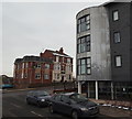
Nottingham, NG3 - St Ann's
A view of the former Lord Alcester pub near the top of St Mathias' Road as seen from Woodhouse Street. The metallic bow-edged building is part of an apartment complex called Albany House, that hosts a community cafe. The pub was built in the 1950s but was extended and converted into nine self-contained flats in 2012.
Image: © David Hallam-Jones
Taken: 24 Jan 2013
0.11 miles
10
Church of St Mathias
Small gothic-style church from 1867, it is now out of use and it looks as if interior demolition may already be under way.
Image: © Alan Murray-Rust
Taken: 8 Mar 2009
0.11 miles


