IMAGES TAKEN NEAR TO
Mercia Drive, GRANTHAM, NG32 3QQ
Introduction
This page details the photographs taken nearby to Mercia Drive, NG32 3QQ by members of the Geograph project.
The Geograph project started in 2005 with the aim of publishing, organising and preserving representative images for every square kilometre of Great Britain, Ireland and the Isle of Man.

There are currently over 7.5m images from over14,400 individuals and you can help contribute to the project by visiting https://www.geograph.org.uk
Image Map
Images are licensed for reuse under creativecommons.org/licenses/by-sa/2.0
Notes
- Clicking on the map will re-center to the selected point.
- The higher the marker number, the further away the image location is from the centre of the postcode.
Image Listing (14 Images Found)
Images are licensed for reuse under creativecommons.org/licenses/by-sa/2.0
Image
Details
Distance
1

Horse grazing on the edge of Ancaster
New housing developments and pony paddocks compete for land on the edge of the village. The houses are part of the Charlestown development.
Image: © Simon Mortimer
Taken: 1 Jan 2009
0.17 miles
2

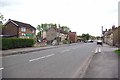
Bungalow on Ermine Street
This bungalow was displaying one of the few bits of referendum material I have seen in Lincolnshire
Image: © Bob Harvey
Taken: 23 Jun 2016
0.17 miles
3

Home Made propaganda
With handwritten notes, a newspaper front page, and some flags this householder left me in no doubt of his political views.
See Image for the bungalow itself
Image: © Bob Harvey
Taken: 23 Jun 2016
0.17 miles
4
Ermine St & Meadowbrook
Ancaster is clearly not fossilised in its past. New development is still taking place keep it as a living community.
Image: © Glyn Baker
Taken: 13 May 2012
0.18 miles
5
Post Office on Ermine St
Ancaster Post Office stands on one of the oldest communication routes in the country
Image: © Glyn Baker
Taken: 13 May 2012
0.19 miles
6

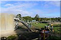
Wilsford Lane at the junction with Roman Way, Ancaster
Roman Way leads to the fields on the south side of Ancaster where the small Roman town was sited. There is little to see now.
Image: © Tim Heaton
Taken: 28 Sep 2022
0.19 miles
8
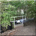
Sewage outfall to The Beck, Ancaster
This small stream, The Beck, is all that remains of an earlier version of the great River Trent, which used to flow through the 'Ancaster Gap' in mid-Pleistocene times
Image: © Tim Heaton
Taken: 28 Sep 2022
0.21 miles

10

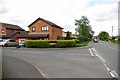
Ancaster Telephone Exchange, Lincs
Situated in Willsford Lane, this modern redbrick building would have replaced a smaller building from the GPO era in the same village some years ago. It has the code EMANCAS and provides telephone and broadband services to 899 residential and 46 non-residential premises in Ancaster plus Kelby, Sudbrook, Welby, West Willoughby and Wilsford nearby. A square white BT warning notice can be seen on the front of this building. The numbering ranges of this TE are (01400) 230xxx, 231xxx, the (01400) referring to the Honington (Lincs) group of five TEs, and its postcode is NG32 3PS.
Image: © David Hillas
Taken: 15 Jul 2019
0.22 miles