IMAGES TAKEN NEAR TO
Lincoln Road, GRANTHAM, NG32 3DB
Introduction
This page details the photographs taken nearby to Lincoln Road, NG32 3DB by members of the Geograph project.
The Geograph project started in 2005 with the aim of publishing, organising and preserving representative images for every square kilometre of Great Britain, Ireland and the Isle of Man.

There are currently over 7.5m images from over14,400 individuals and you can help contribute to the project by visiting https://www.geograph.org.uk
Image Map
Images are licensed for reuse under creativecommons.org/licenses/by-sa/2.0
Notes
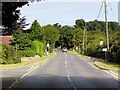
- Clicking on the map will re-center to the selected point.
- The higher the marker number, the further away the image location is from the centre of the postcode.
Image Listing (15 Images Found)
Images are licensed for reuse under creativecommons.org/licenses/by-sa/2.0
Image
Details
Distance
2
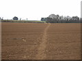
Footpath over field off Frieston Heath Lane
Image: © JThomas
Taken: 29 Feb 2012
0.08 miles
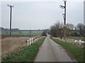
5
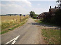
Wrong Camouflage
The soldiers marching down Frieston Heath Lane are just about to vanish into the camouflage of one of the few trees in this area.
Image: © Michael Patterson
Taken: 28 Jul 2006
0.10 miles
6
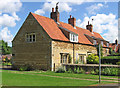
Frieston - cottages on Hough Road
The nearest cottage is No 14.
Image: © Dave Bevis
Taken: 30 Jun 2014
0.11 miles
7
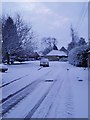
Hough Road, Frieston
Hough Road, Frieston taken east facing
Image: © Patrick Welby-Everard
Taken: 27 Dec 2005
0.14 miles
8
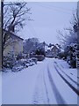
Hough Road, Frieston
This photo was taken west facing.
Image: © Patrick Welby-Everard
Taken: 27 Dec 2005
0.16 miles
9
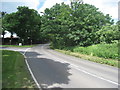
The junction of Lincoln Road and High Street, Caythorpe
Long ago the road to Lincoln would have been via the High Street and then at a later date along what is now Old Lincoln Road.
Image: © Jonathan Thacker
Taken: 6 Jun 2012
0.19 miles
10
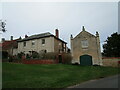
Denver House and the Trap House
Denver House (left) is a refronted seventeenth century house https://historicengland.org.uk/listing/the-list/list-entry/1165463
The Trap House was built in 1846 https://historicengland.org.uk/listing/the-list/list-entry/1062395
Image: © Jonathan Thacker
Taken: 26 Dec 2020
0.21 miles