IMAGES TAKEN NEAR TO
The Leas, GRANTHAM, NG32 2PD
Introduction
This page details the photographs taken nearby to The Leas, NG32 2PD by members of the Geograph project.
The Geograph project started in 2005 with the aim of publishing, organising and preserving representative images for every square kilometre of Great Britain, Ireland and the Isle of Man.

There are currently over 7.5m images from over14,400 individuals and you can help contribute to the project by visiting https://www.geograph.org.uk
Image Map
Images are licensed for reuse under creativecommons.org/licenses/by-sa/2.0
Notes
- Clicking on the map will re-center to the selected point.
- The higher the marker number, the further away the image location is from the centre of the postcode.
Image Listing (4 Images Found)
Images are licensed for reuse under creativecommons.org/licenses/by-sa/2.0
Image
Details
Distance
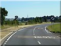
2
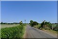
Hough Road leading north from Barkston
Start of a pleasant cycle run towards Hough-on-the-Hill
Image: © Tim Heaton
Taken: 16 Jun 2023
0.14 miles