
IMAGES TAKEN NEAR TO
Sedgebrook, GRANTHAM, NG32 2HA
Introduction
This page details the photographs taken nearby to NG32 2HA by members of the Geograph project.
The Geograph project started in 2005 with the aim of publishing, organising and preserving representative images for every square kilometre of Great Britain, Ireland and the Isle of Man.

There are currently over 7.5m images from over14,400 individuals and you can help contribute to the project by visiting https://www.geograph.org.uk
Image Map
Images are licensed for reuse under creativecommons.org/licenses/by-sa/2.0
Notes
- Clicking on the map will re-center to the selected point.
- The higher the marker number, the further away the image location is from the centre of the postcode.
Image Listing (8 Images Found)
Images are licensed for reuse under creativecommons.org/licenses/by-sa/2.0
Image
Details
Distance
3
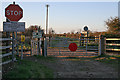
Unmanned Level Crossing near Muston
The small sign over the crossing says "Have you closed the gates?" This is Sewstern Lane, see http://archive.is/V6lz
Image: © Kate Jewell
Taken: 16 Apr 2006
0.20 miles
4
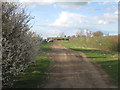
Modern day drovers?
Sewstern Lane is an ancient drove road and over the centuries will have seen many camping on its verges.
Image: © Jonathan Thacker
Taken: 10 Apr 2012
0.23 miles
5
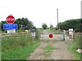
Level crossing on Viking Way W of Sedgebrook
Image: © Colin Park
Taken: 19 Jul 2014
0.24 miles
6
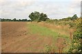
Harvested field nr Muston
The main railway from Grantham to Nottingham is on the right. This field has been harvested and is awaiting replanting.
Image: © roger geach
Taken: 25 Aug 2010
0.24 miles
7
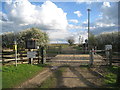
Sewstern Lane level crossing
Looking south towards the A52.
Image: © Jonathan Thacker
Taken: 10 Apr 2012
0.24 miles
8
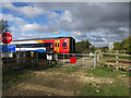
Level Crossing east of Bottesford
The crossing near Muston seems to have the latest in warning signals: useful as it's a busy line.
Image: © Andy Stephenson
Taken: 14 Oct 2015
0.24 miles