
IMAGES TAKEN NEAR TO
Lings Close, GRANTHAM, NG32 1SJ
Introduction
This page details the photographs taken nearby to Lings Close, NG32 1SJ by members of the Geograph project.
The Geograph project started in 2005 with the aim of publishing, organising and preserving representative images for every square kilometre of Great Britain, Ireland and the Isle of Man.

There are currently over 7.5m images from over14,400 individuals and you can help contribute to the project by visiting https://www.geograph.org.uk
Image Map
Images are licensed for reuse under creativecommons.org/licenses/by-sa/2.0
Notes
- Clicking on the map will re-center to the selected point.
- The higher the marker number, the further away the image location is from the centre of the postcode.
Image Listing (209 Images Found)
Images are licensed for reuse under creativecommons.org/licenses/by-sa/2.0
Image
Details
Distance
1
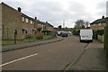
Lings Close
1960s council housing, now nearly all in private ownership.
Image: © Kate Jewell
Taken: 25 Dec 2008
0.02 miles
2
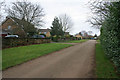
Vicarage Lane
Looking west from the Blue Pot Lane junction.
Image: © Kate Jewell
Taken: 25 Dec 2008
0.03 miles
3
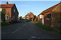
Vicarage Lane, Eaton
Vicarage Lane runs right round the north side of Eaton and rejoins Main Street below the church. The stable on the right belongs to the cottage on the left.
Image: © Kate Jewell
Taken: 21 Oct 2007
0.03 miles
4
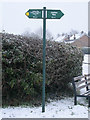
Jubilee Way signpost
On the corner of Vicarage Lane. The seat is a memorial bench to 2nd World War veterans.
The snow was coming down quite swiftly, you can just make out the falling flakes if you look at the darker areas of the photograph.
Image: © Kate Jewell
Taken: 5 Jan 2010
0.03 miles
5
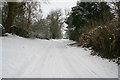
Vicarage Lane, Eaton
Looking west
Compare with Image which was taken further up.
Image: © Kate Jewell
Taken: 5 Feb 2009
0.04 miles
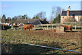
7
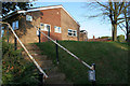
Eaton Village Hall
Built in the second half of the 20th Century this village hall is in a totally unsympathetic style to the rest of the village. It is in a prominent position above Main Street as well.
Image: © Kate Jewell
Taken: 21 Oct 2007
0.04 miles
8
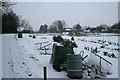
No gardening today!
Eaton Vicarage Lane allotments under a covering of snow.
Image: © Kate Jewell
Taken: 5 Jan 2010
0.05 miles
9
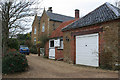
Large house on Blue Pot Lane
This large house, once the farmhouse for Manor Farm, is built of local ironstone with limestone detail. The roof tiles are Bottesford blues, glazed pan tiles which were made in Bottesford during the 19th and early 20th centuries. Sadly the "recipe" was lost when the tile works shut down but there is talk of some enterprising people working on recreating them.
Image: © Kate Jewell
Taken: 25 Dec 2008
0.05 miles
10
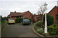
Eaton Court, Vicarage Lane
Built during the early 1990s this development was designed as over 60's accommodation managed by the old people's home next door. (See Image) Now this is now longer in existence as a home I'm not sure of the status of these.
Image: © Kate Jewell
Taken: 25 Dec 2008
0.05 miles