IMAGES TAKEN NEAR TO
Cliffe Road, GRANTHAM, NG31 8HS
Introduction
This page details the photographs taken nearby to Cliffe Road, NG31 8HS by members of the Geograph project.
The Geograph project started in 2005 with the aim of publishing, organising and preserving representative images for every square kilometre of Great Britain, Ireland and the Isle of Man.

There are currently over 7.5m images from over14,400 individuals and you can help contribute to the project by visiting https://www.geograph.org.uk
Image Map
Images are licensed for reuse under creativecommons.org/licenses/by-sa/2.0
Notes
- Clicking on the map will re-center to the selected point.
- The higher the marker number, the further away the image location is from the centre of the postcode.
Image Listing (16 Images Found)
Images are licensed for reuse under creativecommons.org/licenses/by-sa/2.0
Image
Details
Distance
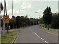
1
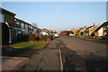
Stevenson Avenue, Gonerby Hill Foot, Grantham
In the Thatcher era there was a building boom in Grantham supposedly to house all the London commuters that had discovered the benefits of living in a Lincolnshire town only 76 minutes from King's Cross. Gonerby Hill Foot, not surprisingly at the bottom of Gonerby Hill, is mainly 70s and 80s housing.
Image: © Kate Jewell
Taken: 28 Jan 2006
0.09 miles
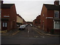
3
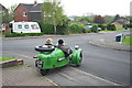
Gonerby Hill Foot
View Down Stephenson Avenue from Cochran Close.
The Morgan, restored by its present owners, is on a visit from Solihull to its previous owner, who sold it over 50 years previously!
Image: © Chris
Taken: 4 May 2008
0.10 miles
5
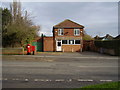
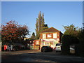
Empty, a victim of the cut backs
The former Gonerby Hill Foot post office stands empty.
Post Box No: NG31 121.
Image: © Anthony Vosper
Taken: 24 Feb 2011
0.10 miles
7
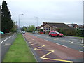
Gonerby Hill, Grantham
Looking towards Stephenson Avenue
Image: © David Howard
Taken: 7 May 2023
0.12 miles
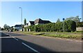
8
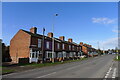
Grantham's South African connection
Ladysmith and Kimberley Terraces and Pretoria road.
Image: © Anthony Vosper
Taken: 14 Feb 2012
0.12 miles
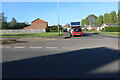
9
Ladysmith Terrace, Gonerby Road, Grantham
Circa 1900 housing built on the Great North Road (former A1). The name derives from the town of Ladysmith in South Africa, an important British stronghold in the Second Boer War, itself named after 'Lady Smith' the Spanish wife of Sir Harry Smith, the Governor of the Cape Colony.
Image: © Tim Heaton
Taken: 9 Mar 2021
0.13 miles