IMAGES TAKEN NEAR TO
The Haverlands, GRANTHAM, NG31 8HB

Introduction

This page details the photographs taken nearby to The Haverlands, NG31 8HB by members of the Geograph project.

The Geograph project started in 2005 with the aim of publishing, organising and preserving representative images for every square kilometre of Great Britain, Ireland and the Isle of Man.

There are currently over 7.5m images from over14,400 individuals and you can help contribute to the project by visiting https://www.geograph.org.uk

Image Map


Images are licensed for reuse under creativecommons.org/licenses/by-sa/2.0
Notes
  • Clicking on the map will re-center to the selected point.
  • The higher the marker number, the further away the image location is from the centre of the postcode.

Image Listing (11 Images Found)

Images are licensed for reuse under creativecommons.org/licenses/by-sa/2.0
Image
Details
Distance
1
The Haverlands
Image: © JThomas Taken: 3 May 2012
0.03 miles
2
Take the high road
The A1174 runs uphill towards Great Gonerby, this is one of the few inclines in the area.
Image: © Anthony Vosper Taken: 24 Feb 2011
0.06 miles
3
School Safety Zone, Gonerby Road
Image: © David Dixon Taken: 5 Aug 2014
0.13 miles
4
B1174 towards Grantham
Image: © JThomas Taken: 3 May 2012
0.15 miles
5
Gonerby Hill Foot Primary School
Image: © JThomas Taken: 3 May 2012
0.15 miles
6
Entering Great Gonerby
This is the only place that I've encountered the vertical warning red strips on the approach to a settlement. St Sebastian's church spire can be seen in the distance.
Image: © Anthony Vosper Taken: 14 Feb 2012
0.19 miles
7
Brendon Close, Gonerby Hill Foot
On the north western edge of Gonerby Hill Foot, this housing estate was built in the early 1990s. It has a good mix if house sizes and styles making an attractive residential area between Grantham Road and the railway line.
Image: © Kate Jewell Taken: 19 Nov 2006
0.20 miles
8
Gonerby Hill Groceries
Image: © Jonathan Thacker Taken: 3 Nov 2019
0.20 miles
9
Bridge over Grantham to Nottingham line
Abandoned bridge over Grantham to Nottingham line. Originally to connect Gonerby Hill Foot to Little Gonerby. Appears on maps circa 1900 but not sure when constructed. Possibly predates the Gonerby Tunnel (to left of image) which offers a far easier means of crossing the railway. Now inaccessible behind several fences and an excavated bank. View from South side looking towards Gonerby Hill Foot.
Image: © Richard Bamford Taken: 3 May 2020
0.23 miles
10
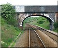
Bridge No3
After the rail line leaves Grantham there is a choice of route at Nottingham Junction. This is the first bridge if the west bound route is taken. It is quite possible that it forms the physical western edge to square SK9037. It carries no metalled surface, just a rough path.
Image: © Donnylad Taken: 2 May 2006
0.24 miles