
IMAGES TAKEN NEAR TO
Harlaxton Road, GRANTHAM, NG31 7UD
Introduction
This page details the photographs taken nearby to Harlaxton Road, NG31 7UD by members of the Geograph project.
The Geograph project started in 2005 with the aim of publishing, organising and preserving representative images for every square kilometre of Great Britain, Ireland and the Isle of Man.

There are currently over 7.5m images from over14,400 individuals and you can help contribute to the project by visiting https://www.geograph.org.uk
Image Map
Images are licensed for reuse under creativecommons.org/licenses/by-sa/2.0
Notes
- Clicking on the map will re-center to the selected point.
- The higher the marker number, the further away the image location is from the centre of the postcode.
Image Listing (16 Images Found)
Images are licensed for reuse under creativecommons.org/licenses/by-sa/2.0
Image
Details
Distance
1
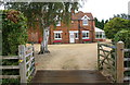
Entrance to farmhouse at Echo Farm
There is an Ordnance Survey benchmark Image on the right hand side of the house on the approach to the conservatory
Image: © phil Richards
Taken: 9 Sep 2019
0.00 miles
2
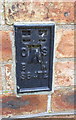
Benchmark on house at Echo Farm
Ordnance Survey flush bracket (serial identifier S8472) described on the Bench Mark Database at www.bench-marks.org.uk/bm18990
Image: © phil Richards
Taken: 9 Sep 2019
0.01 miles
3

A607 towards Grantham
The driveway to Echo Farm is on the right.
Image: © J.Hannan-Briggs
Taken: 31 Jul 2016
0.10 miles
4
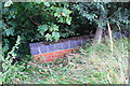
Brick parapet of culvert on NW side of A607 at Echo Spinney
The 1931 Map shows an Ordnance Survey benchmark on the back of a culvert wall here, levelled at 221.57 feet above Newlyn Datum. The benchmark probably refers to a flush bracket with serial number 2083 with details on the Bench Mark Database at www.bench-marks.org.uk/bm1899
Image: © phil Richards
Taken: 9 Sep 2019
0.10 miles
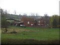
6
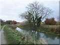
The Grantham Canal near Harlaxton Lower Lodge
Image: © Jonathan Thacker
Taken: 26 Nov 2019
0.15 miles
7
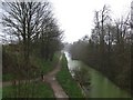
Grantham Canal from Vincent Bridge
The viewpoint is from Vincent Bridge which is just out of the square
Image: © Andrew Tatlow
Taken: 19 Apr 2006
0.16 miles
8
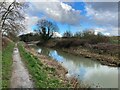
The Grantham Canal
Seen here close to, and looking towards the western fringes of the town.
Image: © Jonathan Clitheroe
Taken: 2 Mar 2024
0.18 miles
9
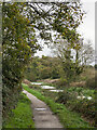
Canal heading north of east towards Grantham
The Grantham Canal approaching its severance short of the original terminus in the town of Grantham. Within a kilometre of this location, by the creation of the A1 Grantham bypass, a stretch of the original line of the waterway has been obliterated.
Image: © Trevor Littlewood
Taken: 8 Nov 2022
0.18 miles
10
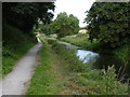
Grantham Canal east of Vincent Bridge
This is the one really straight section of the canal where it cuts through the watershed between the River Trent catchment and that of the River Witham at Grantham. The towpath is part of Sustrans national cycle route 15.
Image: © Alan Murray-Rust
Taken: 11 Aug 2013
0.20 miles