IMAGES TAKEN NEAR TO
Bridge End Road, GRANTHAM, NG31 7TT
Introduction
This page details the photographs taken nearby to Bridge End Road, NG31 7TT by members of the Geograph project.
The Geograph project started in 2005 with the aim of publishing, organising and preserving representative images for every square kilometre of Great Britain, Ireland and the Isle of Man.

There are currently over 7.5m images from over14,400 individuals and you can help contribute to the project by visiting https://www.geograph.org.uk
Image Map
Images are licensed for reuse under creativecommons.org/licenses/by-sa/2.0
Notes
- Clicking on the map will re-center to the selected point.
- The higher the marker number, the further away the image location is from the centre of the postcode.
Image Listing (19 Images Found)
Images are licensed for reuse under creativecommons.org/licenses/by-sa/2.0
Image
Details
Distance
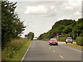
5
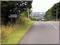
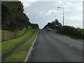
A52 Somerby Hill
The driver of the large red HGV must have been a Geograph enthusiast as he enthusiastically waved his arms around and sounded his horn as he paused behind the photographer's parked car on the hill.
Image: © Andrew Tatlow
Taken: 19 Apr 2006
0.09 miles
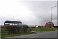
6
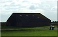
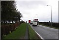
A52 Somerby Hill passing TA Royal Logistics Corps Barracks
Image: © David Dixon
Taken: 7 Aug 2014
0.11 miles
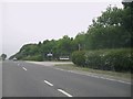
7
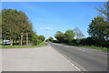
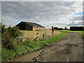
Somerby Hill, Grantham
By the entrance to the barracks.
Image: © David Howard
Taken: 7 May 2023
0.11 miles