IMAGES TAKEN NEAR TO
Rugby Road, NOTTINGHAM, NG2 9TQ

Introduction

This page details the photographs taken nearby to Rugby Road, NG2 9TQ by members of the Geograph project.

The Geograph project started in 2005 with the aim of publishing, organising and preserving representative images for every square kilometre of Great Britain, Ireland and the Isle of Man.

There are currently over 7.5m images from over14,400 individuals and you can help contribute to the project by visiting https://www.geograph.org.uk

Image Map


Images are licensed for reuse under creativecommons.org/licenses/by-sa/2.0
Notes
  • Clicking on the map will re-center to the selected point.
  • The higher the marker number, the further away the image location is from the centre of the postcode.

Image Listing (819 Images Found)

Images are licensed for reuse under creativecommons.org/licenses/by-sa/2.0
  • ...
Image
Details
Distance
1
West Bridgford: offices becoming flats
A view across Pavilion Road, with the Nottingham Forest club shop on the right. The large scaffolded building was built in the 1960s as an hotel but was for many years used as offices by Rushcliffe Borough Council. It is now being converted to flats and extended at each end. Image] is a comparable picture taken in June 2018.
Image: © John Sutton Taken: 6 Apr 2019
0.01 miles
2
Former civic centre, Pavilion Road, Nottingham
The former headquarters of Rushcliffe Borough Council, a stone's throw from the city of Nottingham, was built as a hotel in the 1960s before the council took occupancy in 1982. It has since been converted into flats, Waterside Apartments (Image]).
Image: © Stephen Richards Taken: 19 Jun 2015
0.01 miles
3
Converting the council offices
The former Rushcliffe Borough Council offices (originally an hotel) are being converted to flats. The building has been gutted and most of its windows removed. The view is from an open window in the cafeteria in the Radcliffe Road End of Trent Bridge Cricket Ground.
Image: © John Sutton Taken: 27 Jun 2018
0.01 miles
4
Rushcliffe Civic Centre
Overlooking the Trent and its bridge.
Image: © Mick Garratt Taken: 7 Nov 2007
0.01 miles
5
Rushcliffe Civic Centre
The offices of Rushcliffe Borough Council are housed in a former hotel on the south bank of the River Trent.
Image: © Graham Hogg Taken: 11 Nov 2013
0.02 miles
6
Waterside Apartments and the Nottingham Forest shop
The former Rushcliffe Borough Council offices are being converted to flats. Comparable earlier views: Image] (September 2014) Image] (June 2018) Image] (July 2019)
Image: © John Sutton Taken: 11 Sep 2019
0.02 miles
7
Waterside Apartments from the City Ground
The former Rushcliffe Borough Council offices are being converted to flats. Comparable earlier views: Image] (September 2014) Image] (June 2018)
Image: © John Sutton Taken: 13 Jul 2019
0.02 miles
8
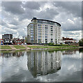
Trentside reflections
Recently converted to flats, the large curved building was built as an hotel about 1960 but was for many years the headquarters of Rushcliffe Borough Council. Two of the boat clubs are to the left.
Image: © John Sutton Taken: 5 May 2023
0.02 miles
9
Under Trent Bridge
Looking north to the city side of the river on a bright Sunday morning in June.
Image: © John Sutton Taken: 22 Jun 2014
0.02 miles
10
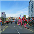
Match day on Trentside
On the right some Nottingham Forest fans are having a drink in the Waterside Bar before the match against Swansea City. The Waterside Apartments are on the right and the new Trent Bridge Quays development is on the other side of the River Trent. The Reds, already assured of a place in the play-offs, won 5-1 to keep alive the possibility of automatic promotion, with two games of the season remaining.
Image: © John Sutton Taken: 30 Apr 2022
0.02 miles
  • ...