IMAGES TAKEN NEAR TO
Wareham Close, NOTTINGHAM, NG2 7UD
Introduction
This page details the photographs taken nearby to Wareham Close, NG2 7UD by members of the Geograph project.
The Geograph project started in 2005 with the aim of publishing, organising and preserving representative images for every square kilometre of Great Britain, Ireland and the Isle of Man.

There are currently over 7.5m images from over14,400 individuals and you can help contribute to the project by visiting https://www.geograph.org.uk
Image Map
Images are licensed for reuse under creativecommons.org/licenses/by-sa/2.0
Notes
- Clicking on the map will re-center to the selected point.
- The higher the marker number, the further away the image location is from the centre of the postcode.
Image Listing (17 Images Found)
Images are licensed for reuse under creativecommons.org/licenses/by-sa/2.0
Image
Details
Distance
1
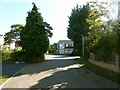
Not 'Christmas Day in West Bridgford'
The best attempt available at recreating this 'First' for the square https://www.geograph.org.uk/photo/95302 which was taken on private property.
Image: © Alan Murray-Rust
Taken: 10 Oct 2021
0.02 miles
2
Christmas Day in West Bridgford
The peaceful and quiet atmosphere outside under a grey sky was broken only by the excited shouts and squeals of my three young grandsons as I took this shot from the doorway of their house at about 12.30pm on Christmas Day.
Image: © Garth Newton
Taken: 25 Dec 2005
0.02 miles
3
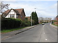
West Bridgford - Rugby Road at Parkstone Close
Image: © Peter Whatley
Taken: 22 Mar 2009
0.03 miles
7
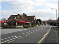
West Bridgford - Identikit Pub on Compton Acres
Amongst the standard houses is this standard modern chain pub.
Image: © Peter Whatley
Taken: 22 Mar 2009
0.19 miles
8
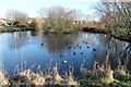
Compton Acres Balancing Pond
Part of a surface water draining system.
Image: © J.Hannan-Briggs
Taken: 2 Feb 2013
0.19 miles
9
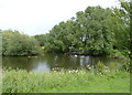
Compton Acres pond
Looking like a traditional village pond, this was specifically created as part of the Compton Acres housing development as a balancing pond for surface water drainage.
Image: © Alan Murray-Rust
Taken: 27 Jun 2012
0.19 miles
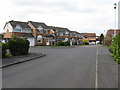
10
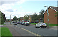
Walcote Drive
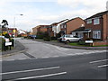
The north end of the Wolds Estate includes a substantial group of maisonette blocks; the rest of the estate is largely detached houses and bungalows.
Image: © Alan Murray-Rust
Taken: 23 Sep 2008
0.20 miles