
IMAGES TAKEN NEAR TO
Musters Road, NOTTINGHAM, NG2 7DQ
Introduction
This page details the photographs taken nearby to Musters Road, NG2 7DQ by members of the Geograph project.
The Geograph project started in 2005 with the aim of publishing, organising and preserving representative images for every square kilometre of Great Britain, Ireland and the Isle of Man.

There are currently over 7.5m images from over14,400 individuals and you can help contribute to the project by visiting https://www.geograph.org.uk
Image Map
Images are licensed for reuse under creativecommons.org/licenses/by-sa/2.0
Notes
- Clicking on the map will re-center to the selected point.
- The higher the marker number, the further away the image location is from the centre of the postcode.
Image Listing (59 Images Found)
Images are licensed for reuse under creativecommons.org/licenses/by-sa/2.0
Image
Details
Distance
1
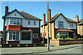
Nos. 16 and 18 Selby Road
There is an OS benchmark Image on the corner, road face, of the wall in front of the right hand house
Image: © Roger Templeman
Taken: 14 May 2018
0.04 miles
2
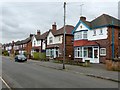
Selby Road, West Bridgford
Typical of this extensive development of inter-war housing. There is a bench mark http://www.geograph.org.uk/photo/5291039 on the stone pier at the right hand side of the picture.
Image: © Alan Murray-Rust
Taken: 20 Feb 2017
0.04 miles
3
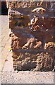
Benchmark on wall corner outside #16 Selby Road
Ordnance Survey cut mark benchmark described on the Bench Mark Database at https://www.bench-marks.org.uk/bm82483
Image: © Roger Templeman
Taken: 14 May 2018
0.04 miles
4
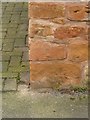
Bench mark, 16 Selby Road, West Bridgford
See http://www.geograph.org.uk/photo/5291042 for location.
Image: © Alan Murray-Rust
Taken: 20 Feb 2017
0.04 miles
5
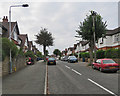
West Bridgford: up Selby Road
A picture taken from near the corner of Devonshire Road on a cloudy September morning.
Image: © John Sutton
Taken: 5 Sep 2018
0.05 miles
6
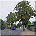
West Bridgford: on Musters Road
Between the Eton Road and Devonshire Road turns.
Image: © John Sutton
Taken: 5 Sep 2018
0.05 miles
7
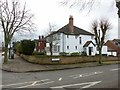
Kingston Road at Musters Road
Taken to locate the bench mark seen here http://www.geograph.org.uk/photo/5291007 . Originally on the corner, the mark now appears in line with the left hand side of the porch of the house.
Image: © Alan Murray-Rust
Taken: 20 Feb 2017
0.07 miles
8
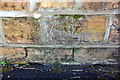
Benchmark on Kingston Road wall at Musters Road junction
Ordnance Survey cut mark benchmark described on the Bench Mark Database at http://www.bench-marks.org.uk/bm82487
Image: © Roger Templeman
Taken: 14 May 2018
0.08 miles
9
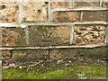
Displaced bench mark, Kingston Road, West Bridgford
See http://www.geograph.org.uk/photo/5291009 for location. The mark used to be right on the corner, but was clearly moved when the wall was rebuilt at some stage, and inserted upside down to indicate that it is no longer a valid mark.
Image: © Alan Murray-Rust
Taken: 20 Feb 2017
0.08 miles
10
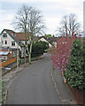
Devonshire Road from the railway bridge
Looking over the parapet towards the corner of Selby Road. This section of the trackbed of the Nottingham-Melton railway, closed in 1968, is now a footpath and nature reserve, The Green Line. For a summer version of this view, see David Lally’s Image] (June 2009).
Image: © John Sutton
Taken: 2 May 2016
0.08 miles