IMAGES TAKEN NEAR TO
Whinlatter Drive, NOTTINGHAM, NG2 6QS
Introduction
This page details the photographs taken nearby to Whinlatter Drive, NG2 6QS by members of the Geograph project.
The Geograph project started in 2005 with the aim of publishing, organising and preserving representative images for every square kilometre of Great Britain, Ireland and the Isle of Man.

There are currently over 7.5m images from over14,400 individuals and you can help contribute to the project by visiting https://www.geograph.org.uk
Image Map
Images are licensed for reuse under creativecommons.org/licenses/by-sa/2.0
Notes
- Clicking on the map will re-center to the selected point.
- The higher the marker number, the further away the image location is from the centre of the postcode.
Image Listing (61 Images Found)
Images are licensed for reuse under creativecommons.org/licenses/by-sa/2.0
Image
Details
Distance
1
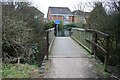
Footbridge
Over a small brook near the Grantham Canal. It joins the end of Stamford Road to the newer estates around Gamston.
Image: © David Lally
Taken: 27 Jan 2010
0.11 miles
2
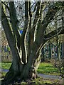
Ash tree alongside the Grantham Canal
This looks to have regrown from the stump of a tree felled many years ago.
Image: © Alan Murray-Rust
Taken: 10 Dec 2021
0.13 miles
3
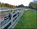
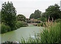
Grantham Canal
View west from Elnor's Bridge, also known as Minor's Bridge (No.6) at the tail of Gamston Lock on the disused Grantham Canal.
Image: © Richard Croft
Taken: 3 Sep 2012
0.13 miles
4
Near Gamston Lock
The footbridge replaces the original brick bridge. The canal was opened in 1797 and abandoned in 1936. Many of its bridges were demolished after the War and replaced by footbridges or flat road crossings.
Image: © John Sutton
Taken: 29 Jun 2015
0.14 miles
5
Bridge No.6
Immediately below Gamston Lock, this is a traditional bridge site, but with a modern footbridge connecting the two halves of the Gamston development.
Image: © Alan Murray-Rust
Taken: 13 Dec 2009
0.14 miles
6
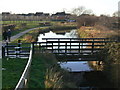
Bridge No.6
Immediately below Gamston Lock, this is a traditional bridge site, but with a modern footbridge connecting the two halves of the Gamston development.
Image: © Alan Murray-Rust
Taken: 13 Dec 2009
0.14 miles
7
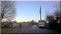
More mobile phone capacity being installed beneath the moon
With well protected allotments to the left
Image: © Chris Morgan
Taken: 7 Feb 2017
0.15 miles
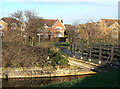
8
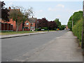
Leahurst Road
With Leahurst Gardens to the left.
Image: © Kate Jewell
Taken: 4 Jun 2010
0.15 miles
9
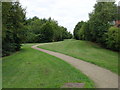
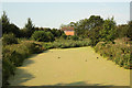
Green Corridor
Between Edwalton and Gamston
Image: © Oxymoron
Taken: 7 Aug 2008
0.15 miles