IMAGES TAKEN NEAR TO
Leahurst Road, NOTTINGHAM, NG2 6JD
Introduction
This page details the photographs taken nearby to Leahurst Road, NG2 6JD by members of the Geograph project.
The Geograph project started in 2005 with the aim of publishing, organising and preserving representative images for every square kilometre of Great Britain, Ireland and the Isle of Man.

There are currently over 7.5m images from over14,400 individuals and you can help contribute to the project by visiting https://www.geograph.org.uk
Image Map
Images are licensed for reuse under creativecommons.org/licenses/by-sa/2.0
Notes
- Clicking on the map will re-center to the selected point.
- The higher the marker number, the further away the image location is from the centre of the postcode.
Image Listing (31 Images Found)
Images are licensed for reuse under creativecommons.org/licenses/by-sa/2.0
Image
Details
Distance
1
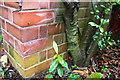
Benchmark on outbuilding at #28 Valley Road
Ordnance Survey cut mark benchmark described on the Bench Mark Database at https://www.bench-marks.org.uk/bm102410
Image: © Roger Templeman
Taken: 12 May 2018
0.10 miles
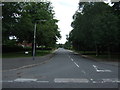
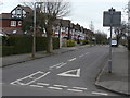
2
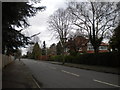
South end of Trevor Road, West Bridgford
Image: © Richard Vince
Taken: 8 Feb 2014
0.10 miles
3
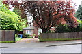
#28 Valley Road
There is an OS benchmark Image on the right hand side of an outbuilding partly hidden by trees to the left of wheelie bins
Image: © Roger Templeman
Taken: 12 May 2018
0.10 miles
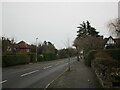
7
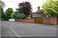
#14 Valley Road
Behind new walls and gates
Image: © Roger Templeman
Taken: 12 May 2018
0.12 miles
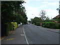
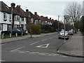
9
Rodney Road
Classic interwar suburbia, typical of West Bridgford's development as a dormitory suburb of Nottingham. Compare with http://www.geograph.org.uk/photo/1772589 and http://www.geograph.org.uk/photo/1772587
Image: © Alan Murray-Rust
Taken: 23 Mar 2010
0.18 miles
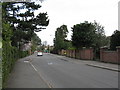
10
Dunster Road
Classic interwar suburbia, typical of West Bridgford's development as a dormitory suburb of Nottingham. Compare with http://www.geograph.org.uk/photo/1772589 and http://www.geograph.org.uk/photo/1772588
Image: © Alan Murray-Rust
Taken: 23 Mar 2010
0.19 miles