
IMAGES TAKEN NEAR TO
Stamford Road, NOTTINGHAM, NG2 6GD
Introduction
This page details the photographs taken nearby to Stamford Road, NG2 6GD by members of the Geograph project.
The Geograph project started in 2005 with the aim of publishing, organising and preserving representative images for every square kilometre of Great Britain, Ireland and the Isle of Man.

There are currently over 7.5m images from over14,400 individuals and you can help contribute to the project by visiting https://www.geograph.org.uk
Image Map
Images are licensed for reuse under creativecommons.org/licenses/by-sa/2.0
Notes
- Clicking on the map will re-center to the selected point.
- The higher the marker number, the further away the image location is from the centre of the postcode.
Image Listing (26 Images Found)
Images are licensed for reuse under creativecommons.org/licenses/by-sa/2.0
Image
Details
Distance
1
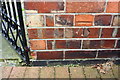
Benchmark on #37 Stamford Road
Ordnance Survey cut mark benchmark described on the Bench Mark Database at https://www.bench-marks.org.uk/bm102409
Image: © Roger Templeman
Taken: 12 May 2018
0.01 miles
2
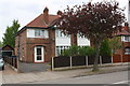
Nos. 37 and 39 Stamford Road
There is an OS benchmark Image on the left hand side of the left hand house at its back corner
Image: © Roger Templeman
Taken: 12 May 2018
0.02 miles
3
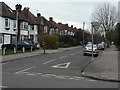
Dunster Road
Classic interwar suburbia, typical of West Bridgford's development as a dormitory suburb of Nottingham. Compare with http://www.geograph.org.uk/photo/1772589 and http://www.geograph.org.uk/photo/1772588
Image: © Alan Murray-Rust
Taken: 23 Mar 2010
0.05 miles
4
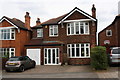
#3 Dunster Road
The wall originally in front of the house has been removed to facilitate parking
Image: © Roger Templeman
Taken: 12 May 2018
0.08 miles
5
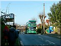
No. 6 bus
Recreating this 'First' for the square http://www.geograph.org.uk/photo/219849 .
No.401 was the first of the new generation of Nottingham City Transport's bio-gas Scania buses to be delivered, in 2017. The inbound bus stop post has gained an electronic departure display, and the trees behind the bus have been recently pollarded.
Image: © Alan Murray-Rust
Taken: 10 Dec 2021
0.08 miles
6
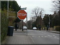
Oversize stop
There is no doubt that you are expected to stop here, but Stamford Road carries quite a heavy traffic flow and many drivers will consider it to be the major road.
Image: © Alan Murray-Rust
Taken: 23 Mar 2010
0.08 miles
7
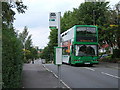
no. 6 bus
looking north from the junction of Trevor Road and Stamford Road, West Bridgford
Image: © Catherine Davis
Taken: 15 Aug 2006
0.08 miles
8
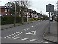
Rodney Road
Classic interwar suburbia, typical of West Bridgford's development as a dormitory suburb of Nottingham. Compare with http://www.geograph.org.uk/photo/1772589 and http://www.geograph.org.uk/photo/1772587
Image: © Alan Murray-Rust
Taken: 23 Mar 2010
0.10 miles
9
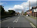
Part of Gordon Road, West Bridgford
Looking towards the shops and central West Bridgford.
Image: © Jeremy Bolwell
Taken: 25 Feb 2024
0.10 miles
10

West Bridgford: up Dunster Road
In 1881 West Bridgford was a village with a population of 293. By the 1901 census the population had risen to 7,018. Bridgford continued to expand throughout the twentieth and twenty-first centuries, absorbing Wilford and Edwalton in the 1930s. The population was 36,487 by the time of the 2021 census.
Image: © John Sutton
Taken: 25 Jun 2025
0.10 miles