
IMAGES TAKEN NEAR TO
Park Avenue, NOTTINGHAM, NG2 6AS
Introduction
This page details the photographs taken nearby to Park Avenue, NG2 6AS by members of the Geograph project.
The Geograph project started in 2005 with the aim of publishing, organising and preserving representative images for every square kilometre of Great Britain, Ireland and the Isle of Man.

There are currently over 7.5m images from over14,400 individuals and you can help contribute to the project by visiting https://www.geograph.org.uk
Image Map
Images are licensed for reuse under creativecommons.org/licenses/by-sa/2.0
Notes
- Clicking on the map will re-center to the selected point.
- The higher the marker number, the further away the image location is from the centre of the postcode.
Image Listing (226 Images Found)
Images are licensed for reuse under creativecommons.org/licenses/by-sa/2.0
Image
Details
Distance
1
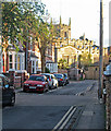
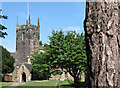
Park Avenue and St Giles' Church
The parish church is brilliantly lit by the setting sun on a cool April evening.
Image: © John Sutton
Taken: 29 Apr 2013
0.02 miles
3
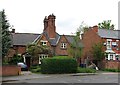
Cottages on Bridgford Road
These cottages are earlier than the majority of West Bridgford's late-Victorian and Edwardian villas, many of which are variations of the one on the right.
Image: © John Sutton
Taken: 9 May 2012
0.03 miles
4

Church Croft, West Bridgford
This modern housing scheme with flats and houses for the retired, comprises narrow lanes, walkways and open spaces. It is sandwiched between Stratford Road and William Road. The Victorian houses in the centre distance are on Strarford Road. See http://www.geograph.org.uk/photo/1269539 and http://www.geograph.org.uk/photo/1267726
Image: © Kate Jewell
Taken: 22 Apr 2009
0.03 miles
5
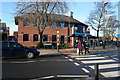
Pizza Express, West Bridgford
On the corner of Bridgford Road opposite the Library. West Bridgford is "blessed" with numerous eateries of which this is probably the largest. Many have pavement tables giving an almost continental air to the town's main shopping area.
Image: © Kate Jewell
Taken: 4 Jan 2010
0.04 miles
7
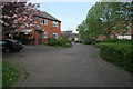
Church Croft, West Bridgford
A modern sheltered housing development with retirement flats, houses and large community centre off Stratford Road.
Image: © Kate Jewell
Taken: 22 Apr 2009
0.04 miles
8

The Monkey Tree Pub & Restaurant
Complete with its own tree.
Image: © J.Hannan-Briggs
Taken: 2 Feb 2013
0.05 miles
9
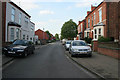
Stratford Road, West Bridgford
Looking towards Bridgford Road. Victorian terraced housing on the right and a modern housing scheme with flats and houses on the far left. See http://www.geograph.org.uk/photo/1269539 http://www.geograph.org.uk/photo/1270161 and http://www.geograph.org.uk/photo/1267726
During the fast growth of Nottingham in the Victorian period pressure was put on the Musters Family, who owned much of the land in West Bridgford, to allow suburban development south of the River Trent. Eventually the Musters sold their land, but they put in place strict planning regulations to the area then known as the West Bridgford Estate. This development was planned over a grid of tree lined streets. The main roads such as Musters Road (see Image) had restrictions on the density of housing and house size. Smaller houses were permitted on side streets, and terraces were erected on roads such as Stratford Road for the servants of the wealthy Nottingham merchants who bought up the larger properties.
It is interesting to note that there are no "Streets" in West Bridgford. Originally many roads were name "Street" but this was felt to be too urban by the Victorian "planners". Thus all street names were changed from "Street" to "Road". The one exception is "Village Street" in Edwalton, a village that has been totally absorbed into the town of West Bridgford.
Image: © Kate Jewell
Taken: 22 Apr 2009
0.05 miles
10
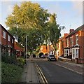
Stratford Road on a September evening
Looking towards Bridgford Road and the Co-op on a late-summer evening.
Image: © John Sutton
Taken: 6 Sep 2018
0.05 miles