IMAGES TAKEN NEAR TO
Pollards Lane, SOUTHWELL, NG25 0TN

Introduction

This page details the photographs taken nearby to Pollards Lane, NG25 0TN by members of the Geograph project.

The Geograph project started in 2005 with the aim of publishing, organising and preserving representative images for every square kilometre of Great Britain, Ireland and the Isle of Man.

There are currently over 7.5m images from over14,400 individuals and you can help contribute to the project by visiting https://www.geograph.org.uk

Image Map


Images are licensed for reuse under creativecommons.org/licenses/by-sa/2.0
Notes
  • Clicking on the map will re-center to the selected point.
  • The higher the marker number, the further away the image location is from the centre of the postcode.

Image Listing (9 Images Found)

Images are licensed for reuse under creativecommons.org/licenses/by-sa/2.0
Image
Details
Distance
1
Public footpath through Cow Pasture
The awkward corner of the field has been given over to woodland plantation with a mix of broadleaf species.
Image: © Alan Murray-Rust Taken: 2 Aug 2020
0.06 miles
2
Durdham Farm
A working farm on the Brackenhurst College estate. The field is called Cow Pasture and shows former ridge and furrow strips.
Image: © Alan Murray-Rust Taken: 2 Aug 2020
0.10 miles
3
Field near Durdham Farm
Looking towards the farm itself, along the course of an all but invisible public footpath.
Image: © Richard Vince Taken: 17 Apr 2014
0.10 miles
4
Durdham Farm
A working farm on the Brackenhurst College estate. The field is called Cow Pasture and is in use as such.
Image: © Alan Murray-Rust Taken: 2 Aug 2020
0.13 miles
5
Public footpath through Middle Meadow
The section of the field cut off by the path has been given over to woodland plantation with a mix of broadleaf species.
Image: © Alan Murray-Rust Taken: 2 Aug 2020
0.16 miles
6
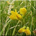
Meadow Pea (Lathyrus pratensis)
A common yellow pea-vetch, at the edge of Middle Meadow. See also http://www.geograph.org.uk/photo/6560231
Image: © Alan Murray-Rust Taken: 2 Aug 2020
0.19 miles
7
Meadow Pea (Lathyrus pratensis)
See also http://www.geograph.org.uk/photo/6560229
Image: © Alan Murray-Rust Taken: 2 Aug 2020
0.19 miles
8
Pasture with shelter
Adjacent to Weldon Farm.
Image: © Alan Murray-Rust Taken: 2 Aug 2020
0.22 miles
9
Weldon Farm
Outbuildings converted to residential use.
Image: © Alan Murray-Rust Taken: 2 Aug 2020
0.24 miles