1
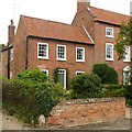
Entering Southwell
On the B6386 road.
Image: © J.Hannan-Briggs
Taken: 30 Jan 2016
0.02 miles
2
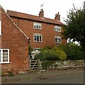
Sunbury Cottage, Oxton Road, Southwell
19th century farm cottage, recently refurbished from a rather dilapidated state.
Image: © Alan Murray-Rust
Taken: 20 Sep 2021
0.06 miles
3
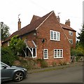
Footpath from Oxton Road to Westhorpe
Surprisingly, this peripheral path has been surfaced at some stage. It runs due north-south along the gridline.
Image: © Alan Murray-Rust
Taken: 19 Jun 2008
0.08 miles
4
Farmland near Westhorpe
An update on this 2008 view https://www.geograph.org.uk/photo/852196 , with a different crop and new polytunnels.
Image: © Alan Murray-Rust
Taken: 20 Sep 2021
0.09 miles
5
Westhorpe, Southwell
The 'thorpe' element of the name reflects the fact that this was a separate community attached to the main town of Southwell.
Image: © Alan Murray-Rust
Taken: 26 Jul 2020
0.11 miles
6
Stafford's Farm, Westhorpe
Former farmhouse, late 18th century, Listed Grade II.
Image: © Alan Murray-Rust
Taken: 26 Jul 2020
0.11 miles
7
Home Farmhouse, Westhorpe
Former farmhouse, late 18th century, Listed Grade II.
Image: © Alan Murray-Rust
Taken: 26 Jul 2020
0.11 miles
8
58 Westhorpe, Southwell
Former farmhouse, mid 18th century with later alterations and additions, Listed Grade II.
Image: © Alan Murray-Rust
Taken: 26 Jul 2020
0.11 miles
9
Home Farm Cottage, Westhorpe
Typically a cottage attached to the main farmhouse behind. Mid 18th century with later alterations, Listed Grade II.
Image: © Alan Murray-Rust
Taken: 26 Jul 2020
0.11 miles
10
Farmland near Westhorpe
A ripening crop of rape is beginning to collapse on itself, although the footpath is still clear enough to follow
Image: © Alan Murray-Rust
Taken: 19 Jun 2008
0.11 miles


