
IMAGES TAKEN NEAR TO
Vicarage Road, SOUTHWELL, NG25 0NN
Introduction
This page details the photographs taken nearby to Vicarage Road, NG25 0NN by members of the Geograph project.
The Geograph project started in 2005 with the aim of publishing, organising and preserving representative images for every square kilometre of Great Britain, Ireland and the Isle of Man.

There are currently over 7.5m images from over14,400 individuals and you can help contribute to the project by visiting https://www.geograph.org.uk
Image Map
Images are licensed for reuse under creativecommons.org/licenses/by-sa/2.0
Notes
- Clicking on the map will re-center to the selected point.
- The higher the marker number, the further away the image location is from the centre of the postcode.
Image Listing (71 Images Found)
Images are licensed for reuse under creativecommons.org/licenses/by-sa/2.0
Image
Details
Distance
3
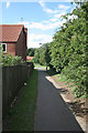
Footpath link to Beaumont Avenue
All the housing developments off either Halam Road or Westgate are linked to the spine footpath along the ridge of High Town.
Image: © Alan Murray-Rust
Taken: 19 Jun 2008
0.07 miles
4
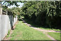
Ridge footpath looking west
At the top of Trinity Road. There is housing development on both side, but the footpath is uninterrupted for nearly 1 kilometre
Image: © Alan Murray-Rust
Taken: 19 Jun 2008
0.07 miles
5
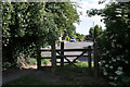
The top of Trinity Road
The link from Trinity Road onto the footpath along the ridge
Image: © Alan Murray-Rust
Taken: 19 Jun 2008
0.07 miles
6
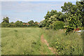
Footpath along the rape field
The rape crop is showing signs of being heavy enough to collapse the crop
Image: © Alan Murray-Rust
Taken: 19 Jun 2008
0.08 miles
7

Footpath along the ridge
The footpath follows the ridge of the high ground to the west of Southwell Town Centre and acts as a divide between housing development on either side
Image: © Alan Murray-Rust
Taken: 19 Jun 2008
0.08 miles
8
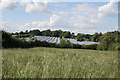
Wheatfield with polytunnels
The crop in the foreground is wheat, but it has been heavily invaded by other grass varieties.
Image: © Alan Murray-Rust
Taken: 19 Jun 2008
0.08 miles
9
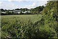
Footpath to Halam Road
The hedge to the right marks the edge of housing development between the ridge and Halam Road.
Image: © Alan Murray-Rust
Taken: 19 Jun 2008
0.08 miles
10
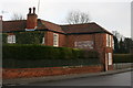
Ghost sign on building in Westhorpe
The building is now an antique shop and was formerly the Grapes Inn. There are at least two generations of lettering on this faded painted sign. One may read 'DAVY'S NEWARK ALES' (1830-1975).
Image: © Graham Hogg
Taken: 19 Jan 2015
0.09 miles