
IMAGES TAKEN NEAR TO
Hopkiln Lane, SOUTHWELL, NG25 0AU
Introduction
This page details the photographs taken nearby to Hopkiln Lane, NG25 0AU by members of the Geograph project.
The Geograph project started in 2005 with the aim of publishing, organising and preserving representative images for every square kilometre of Great Britain, Ireland and the Isle of Man.

There are currently over 7.5m images from over14,400 individuals and you can help contribute to the project by visiting https://www.geograph.org.uk
Image Map
Images are licensed for reuse under creativecommons.org/licenses/by-sa/2.0
Notes
- Clicking on the map will re-center to the selected point.
- The higher the marker number, the further away the image location is from the centre of the postcode.
Image Listing (22 Images Found)
Images are licensed for reuse under creativecommons.org/licenses/by-sa/2.0
Image
Details
Distance
1
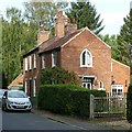
Pedlar's Cottage, 88 Kirklington Road, Southwell
Early 19th century cottage with Gothick windows, Listed Grade II. (The attached house is not part of the Listing)
Image: © Alan Murray-Rust
Taken: 13 Sep 2020
0.09 miles
2
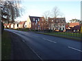
Humberstone Road
Small, modern housing estate off Halam Road, Southwell.
Image: © Ajay Tegala
Taken: 10 Dec 2008
0.13 miles
5
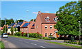
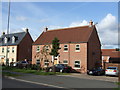
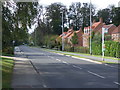
Southwell NG25, Notts.
The new-ish (c.2008) Merryweather Estate, off the Southwell-Halam road. This was a former location of the H. Merryweather & Sons Nursery and it was here that the famous Bramley apple was first cultivated. This is the Humberstone Road turning. The village of Halam lies in the distance, further westwards.
Image: © David Hallam-Jones
Taken: 25 May 2013
0.15 miles
6
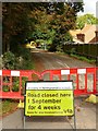
Road closure, Hopkiln Lane, Southwell
In conjunction with local flood alleviation works.
Image: © Alan Murray-Rust
Taken: 6 Sep 2020
0.17 miles
7
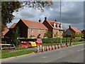
The end of Hopkiln Lane, Southwell
Closed during flood alleviation scheme works. The housing is early 21st century new development.
Image: © Alan Murray-Rust
Taken: 6 Sep 2020
0.18 miles
8
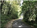
Southwell Urban Fringe
Exiting the town on foot via Kirklington Road.
Image: © Jonathan Clitheroe
Taken: 9 Oct 2020
0.18 miles
9
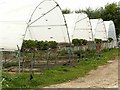
Polytunnels in Norwood Park
Part of the extensive fruit growing business of the Starkey family, The crop here is strawberries.
Image: © Alan Murray-Rust
Taken: 6 Sep 2020
0.21 miles
10
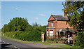
Southwell NG25, Notts.
The Lodge House (or former Lodge House) on Halam Road, at the High Town end of the Norwood Park country estate. Behind the boundary hedge and beyond the lodge is the H. Merryweather & Sons Fruit Farm. Halam Road continues westwards, to the left, towards the village of Halam. Norwood Hall is the home of the Starkey family, whilst some of the ancillary buildings have been converted into function venues ("Norwood Park" venue/s).
Image: © David Hallam-Jones
Taken: 25 May 2013
0.21 miles