1
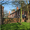
Sneinton: Perlethorpe Avenue
A typical late-Victorian terrace, seen from Green's Mill Park on a bright spring morning.
Image: © John Sutton
Taken: 13 Apr 2016
0.01 miles
2
Sneinton: Perlethorpe Avenue
One of the many streets dating from the expansion of Nottingham in the last quarter of the nineteenth century. Sneinton became part of the Borough in 1877. The view is from the green space round Green's Windmill - a good place to read the paper during a bright interval on spring morning that was mainly cloudy.
Image: © John Sutton
Taken: 15 Apr 2011
0.01 miles
3
Sneinton: in Green's Mill Park
Looking towards St Stephen's Church on a sunny spring morning.
Image: © John Sutton
Taken: 13 Apr 2016
0.02 miles
4
Sneinton: up Perlethorpe Avenue
Bins and backyards, photographed on a June morning.
Image: © John Sutton
Taken: 3 Jun 2017
0.02 miles
5
Nottingham - NG3 (Sneinton)
Sneinton's "Old School Hall", showing the access steps to Green's windmill parallel with the wooden fence. The hall was being used as a community centre until it became unsafe and it is currently (i.e. Nov. 2017) "For Sale".
Image: © David Hallam-Jones
Taken: 7 May 2012
0.02 miles
6
Nottingham - NG3 (Sneinton)
The closed end of the Perlethorpe Avenue. Beyond the boundary wall is a small sloping field and a children's play area in the shadow of Green's Mill (windmill).
Image: © David Hallam-Jones
Taken: 7 May 2012
0.03 miles
7
Nottingham - NG3 (Sneinton)
Perlethorpe Avenue is a very narrow street leading to up to (and into) the closed end of this intimate cul-de-sac obliquely opposite St Stephen's Anglican Church on Sneinton Road.
Image: © David Hallam-Jones
Taken: 7 May 2012
0.03 miles
8
9-13 Dale Street, Nottingham
Picked out by Pevsner for demonstrating "Sneinton's distinctive 1890s tiled doorways and figurative hoodstops".
Image: © Stephen Richards
Taken: 19 Jun 2015
0.03 miles
9
Nottingham - NG3
A view of the footpath connecting the car park and Green's windmill, Sneinton taken from one of the mill windows on a hazy March afternoon.
Image: © David Hallam-Jones
Taken: 22 Mar 2012
0.03 miles
10
Entrance to Green's Windmill and Science Centre
The car-park gateposts are topped with letters and symbols from George Green's mathematical theory of electricity. For more about Green and the windmill, see http://en.wikipedia.org/wiki/George_Green and http://www.nottinghamcity.gov.uk/index.aspx?articleid=1033 .
Image: © John Sutton
Taken: 13 Jun 2013
0.04 miles


