
IMAGES TAKEN NEAR TO
Poulton Drive, NOTTINGHAM, NG2 4BN
Introduction
This page details the photographs taken nearby to Poulton Drive, NG2 4BN by members of the Geograph project.
The Geograph project started in 2005 with the aim of publishing, organising and preserving representative images for every square kilometre of Great Britain, Ireland and the Isle of Man.

There are currently over 7.5m images from over14,400 individuals and you can help contribute to the project by visiting https://www.geograph.org.uk
Image Map
Images are licensed for reuse under creativecommons.org/licenses/by-sa/2.0
Notes
- Clicking on the map will re-center to the selected point.
- The higher the marker number, the further away the image location is from the centre of the postcode.
Image Listing (138 Images Found)
Images are licensed for reuse under creativecommons.org/licenses/by-sa/2.0
Image
Details
Distance
1
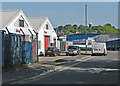
Sneinton: Poulton Drive
Rinus Roofing Supplies on the left, Green's Windmill on the skyline and a large articulated lorry reversing carefully.
Image: © John Sutton
Taken: 16 May 2016
0.03 miles
2
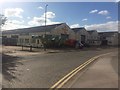
The Cheesecake Shop - and factory
Poulton Drive, Colwick.
Image: © David Lally
Taken: 14 May 2016
0.05 miles
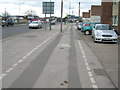
6
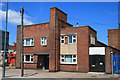
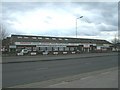
Almor Group office building
On Daleside Road. A basic art-deco style.
Image: © David Lally
Taken: 20 Jun 2010
0.09 miles
7
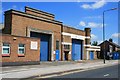
Art-deco factory on Daleside Road
Home of Almor Engineering (now Almor Group). Perhaps ripe for "redevelopment".
The company appears to still be going strong though http://www.almor.co.uk/Home .
Image: © David Lally
Taken: 20 Jun 2010
0.10 miles
8
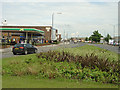
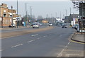
Daleside Road
The main artery through a large old-established industrial estate area in the south east of the city
Image: © Alan Murray-Rust
Taken: 29 May 2008
0.10 miles
9

Trent Basin
At approximately 113 x 36 metres, this was a large dock. The 1954 map shows this as the British Transport Commission's depot, with warehouses lining the wharves. Some of those buildings wree still extant in 2008 Image but nearly all have now gone, the area now being redeveloped for housing.
Image: © Stephen Craven
Taken: 2 Jun 2026
0.11 miles
10
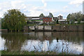
River frontage on the Trent
At first glance this looked like a house with a garden on the river but it's actually a small office block on the other side of Freeth Street. The narrow strip of land between the street and the river is obviously looked after and has a private mooring.
Image: © Kate Jewell
Taken: 1 May 2008
0.11 miles