
IMAGES TAKEN NEAR TO
Kimberley Street, NOTTINGHAM, NG2 4AY
Introduction
This page details the photographs taken nearby to Kimberley Street, NG2 4AY by members of the Geograph project.
The Geograph project started in 2005 with the aim of publishing, organising and preserving representative images for every square kilometre of Great Britain, Ireland and the Isle of Man.

There are currently over 7.5m images from over14,400 individuals and you can help contribute to the project by visiting https://www.geograph.org.uk
Image Map
Images are licensed for reuse under creativecommons.org/licenses/by-sa/2.0
Notes
- Clicking on the map will re-center to the selected point.
- The higher the marker number, the further away the image location is from the centre of the postcode.
Image Listing (109 Images Found)
Images are licensed for reuse under creativecommons.org/licenses/by-sa/2.0
Image
Details
Distance
1
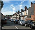
Sneinton: Kimberley Street
Like nearby Mafeking Street, its name commemorates the Boer War.
Image: © John Sutton
Taken: 4 Jul 2016
0.00 miles
2
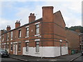
House on the corner of Kimberley Street and Whittier Road
An unusual position for a chimney.
Image: © Jonathan Thacker
Taken: 20 Jul 2012
0.02 miles
3
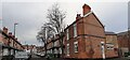
Mafeking Street at Whittier Road junction
Image: © Luke Shaw
Taken: 28 Jan 2022
0.03 miles
4
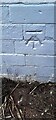
Benchmark on #155 Colwick Road (Baden Powell Road face)
Ordnance survey cut mark benchmark levelled at 25.542m above Newlyn Datum verified 1962
Image: © Roger Templeman
Taken: 28 Jan 2022
0.05 miles
5
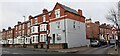
Houses on Colwick Road at Baden Powell Road junction
There is an Ordnance Survey benchmark Image on the right hand face of the house at the corner, about 5 feet from the junction of the house and its front side wall
Image: © Roger Templeman
Taken: 28 Jan 2022
0.05 miles
8
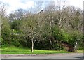
Colwick Road: where the Nottingham Suburban Railway once crossed
The Nottingham Suburban Railway (1889-1951) once crossed high above Colwick Road on a blue-brick arched bridge. The tree in the foreground is where the north abutment was; the footpath to Sneinton Boulevard climbs up where the embankment once was to a partly-filled cutting (see Image]) through the steep hillside.
Image: © John Sutton
Taken: 20 Apr 2012
0.07 miles
10
Colwick Road and Colwick Woods
A view from the corner of Trent Lane on an overcast Sunday morning.
Image: © John Sutton
Taken: 23 Jun 2013
0.08 miles